
Good moooorning! We’re off to a solid start on this Thursday morning, ahead of what may just be the nicest day of the week. Temperatures start off between 27-32 degrees. We may see some patchy ice on untreated roads and sidewalks in the colder spots this morning– be mindful as you head out the door.
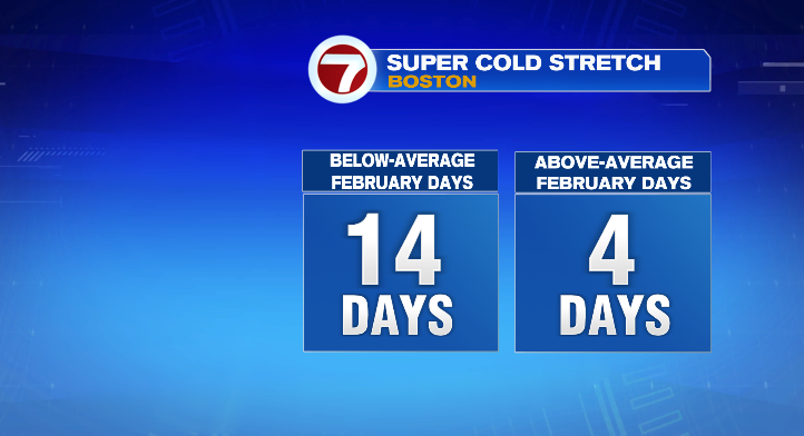
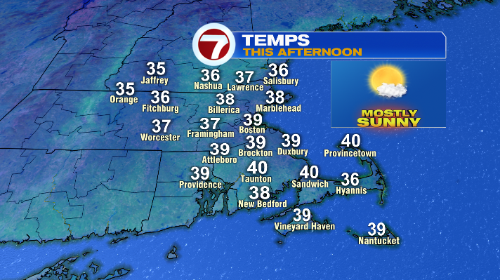
The afternoon looks lovely! We’ll be mostly to partly sunny with light winds and temperatures in the upper 30s and low 40s. While that might not sound like a homerun, it is, in fact, downright average. Considering 14 of 18 February days have been below average, I’ll take the win. Hopefully you agree!
Tonight we’ll start to see the shift– temperatures will be back down in the upper teens and low/mid 20s, but clouds increase ahead of our next storm, which arrives Friday.
This storm will be a wintry, mushy mess for many, but end with snow for just about everyone.
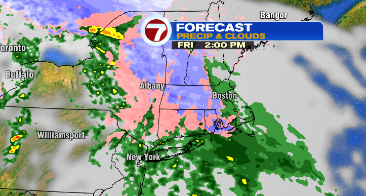

We’ll start with rain/a wintry mix late Friday morning and early Friday afternoon. Areas north of route 2 will switch over to snow first, before areas further south follow suit by Friday evening. Areas along and south of the Mass Pike will have the most mixing, and the least snow, versus areas further north. Towns along and north of route 2 (where the switchover to snow will happen first) have the highest accumulation potential — a widespread 4-6″, with 6+ possible on a localized scale.
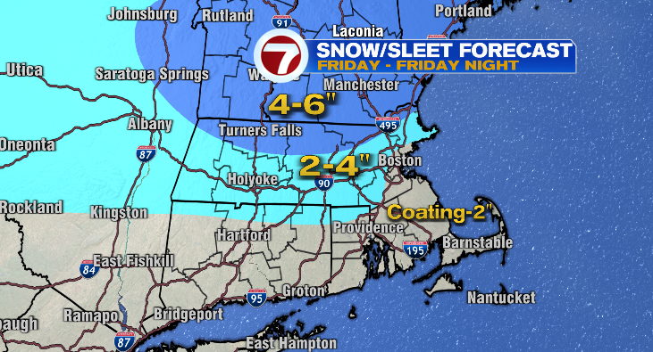
Expect snow to largely taper off by midnight, but we will see spotty snow showers lingering through Saturday afternoon with the last of this storm’s energy.
We get a (short) break for most of Sunday, but we’re looking out for the next storm Sunday night and Monday. This is a coastal storm that currently looks like it’ll hug the coast of New England, bringing snow showers to the Cape, Islands, and southeast MA.
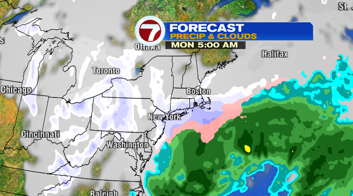
While this storm doesn’t look like a blockbuster, should the track shift juuuust a little bit, that could very much change. We’ll keep you posted on this one– while the track looks relatively settled, there are still a few days until the storm arrives.
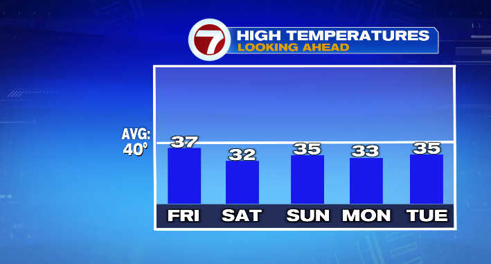
While all of this is happening, temperatures dip a few degrees as well. While it won’t be as frigid as parts of last week were, it will be largely below-average after today. Expect the low to mid 30s through the middle of next week.
About the Author
Discover more from USA NEWS
Subscribe to get the latest posts sent to your email.


