
What a DAY Saturday was! Absolutely stunning. It felt like a nice spring day between the temperatures and the sunshine, perhaps fitting, considering today (March 1) is the first day of meteorological spring!
We like to turn the page on the seasons on the first of the three-month stretch. It’s easier for the sake of record-keeping. Problem is, Mother Nature doesn’t care about the calendar, whether it’s meteorological or astronomical. She’s still set on some winter weather for today.

That winter weather comes at the hands of an arctic front moving through New England. While the front doesn’t have a lot of moisture associated with it, there is just enough that we are going to be dealing with some light snow showers today. Snow showers have begun, and will move west to east across Massachusetts with the last flakes falling across the Cape/Islands in the early afternoon.
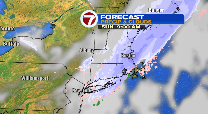
This won’t be a massive snow event– the entire region is looking at a coating to two inches by the time the snow wraps up.
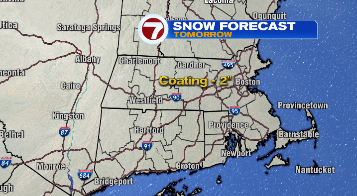
This is what I like to call “aesthetic snow”. Will it look wintry and pretty outside? Yes. Will it pile up and cause massive problems across the area? No. That said, I know many are already groaning at the idea of more snow in general.
What comes after the snow might have you groaning even more though– remember, we’re talking about and arctic front, so arctic air will follow. Temperatures plummet overnight, and we wake up in the single digits on Monday morning. With the breeze, it’ll feel like we’re below zero! Dress accordingly!
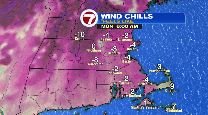
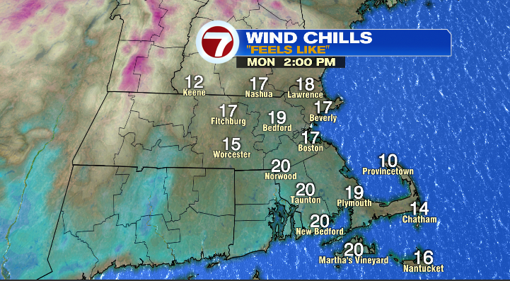
Monday afternoon will be bright and sunny, but still cold with highs only in the 20s, feeling like the teens.
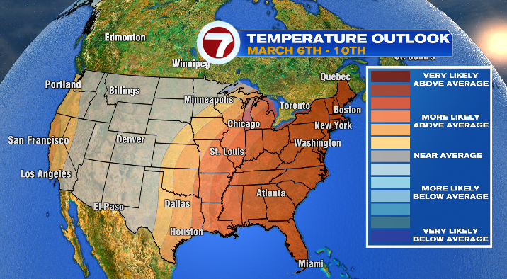
We warm up quite a bit throughout the week– in fact, we’re looking at temperatures between 5 -10 degrees above average on Wednesday, Friday and Saturday. Even the second week of March has a strong signal for a warming trend (see map below). Great for anyone who is sick of the below-average trend that we felt for so much of this winter.
The bad news here, is that as temps go up, so do precipitation chances. Our pattern puts us in the path of a parade of storms between Tuesday and Saturday.
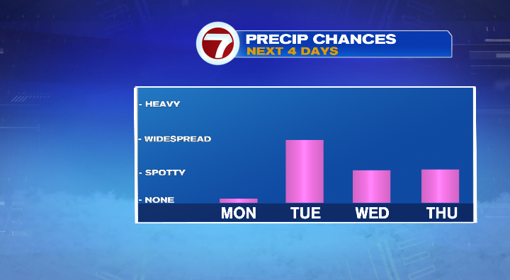
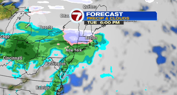
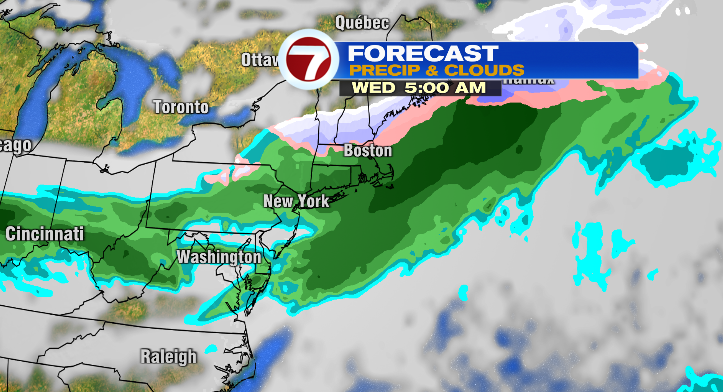
None of them are massive snow-makers. Most of them actually look like they’ll bring more rain/mixing than anything else. The first storm in the parade arrives Tuesday afternoon/evening. This will start as snow, but transition into a rain/mix Tuesday night into Wednesday morning, likely clearing out before noon.
Thursday will be a bit quieter, with a few rain showers possible but no widespread precipitation. The next storm looks like it’ll arrive Friday with a rain/wintry mix, likely continuing into Friday night. We’ll have a lot to track this week! Stay tuned, and we’ll keep you posted on how these storms play out.
About the Author
Discover more from USA NEWS
Subscribe to get the latest posts sent to your email.


