
Damp and dreary conditions have been the story recently. Most of south Florida has been trapped beneath a stubborn deck of clouds with occasional rounds of rain. Here’s a look at downtown Ft. Lauderdale (from our Tower Cam, Wednesday afternoon).
The hovering clouds held temperatures down, making for a cool day by south Florida standards. Morning readings started in the 50’s with the afternoon “stuck in the 60’s”. Interestingly, that appears to be enough to get us into the record books! Although still unofficial at this time, our data suggests Ft. Lauderdale matched the coolest daytime high for the date (at 69-degrees).

An official account of this “potential record” could come soon from the National Weather Service.
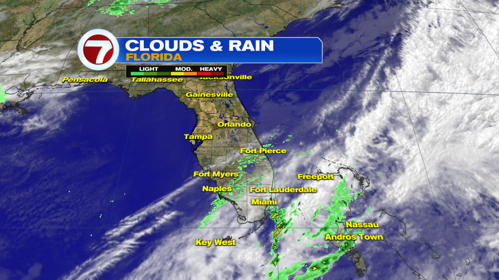
Notice on the satellite-radar composite (shown above) clouds do NOT cover the northern half of the state. That is where there is drier air coming our way over the next day or so. So, if you’re ready to see the sun again, it looks promising beginning Thursday.
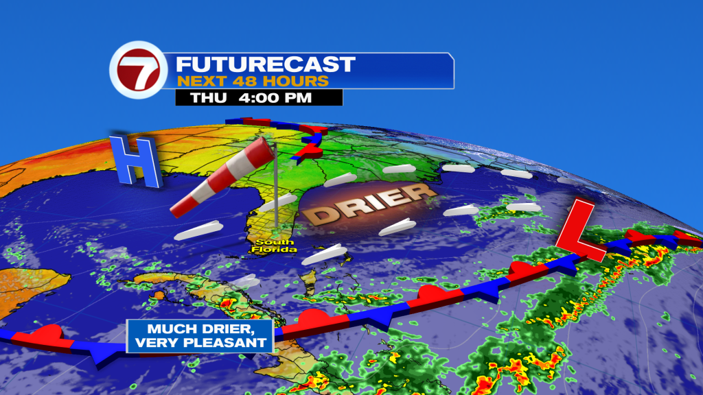
Here’s a look at the weather map as we get more separation from a stationary Front to our south and east. What will build our way? High Pressure centered over the Gulf waters. It’s worth noting that the difference in air pressure will get winds stirring stronger. Winds are expected to gust as high as 30 miles per hour, for the short term.
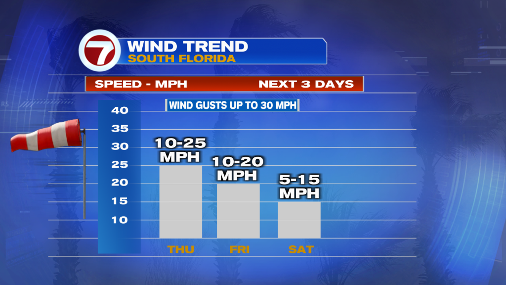
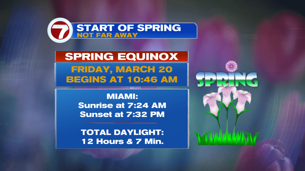
The breezy stretch will carry over into Friday which happens to be the first official day of spring. The new season will be off to a pleasant start. The forecast calls for mild mornings, mostly dry weather, and a good amount of sunshine. This nice setup gets established Saturday and lasts well into next week. We’ll find highs in the lower 80’s (exactly where we “should be” this time of year)!
Copyright 2025 Sunbeam Television Corp. All rights reserved. This material may not be published, broadcast, rewritten or redistributed.
About the Author
Discover more from USA NEWS
Subscribe to get the latest posts sent to your email.


