
The chill is in the air again early this morning with temps starting off in the teens and 20s. The rebound will be nice though with temps in the low to mid 40s this afternoon with a mix of sun and clouds. Temps will be coolest at the immediate coast with a light ocean breeze kicking in.
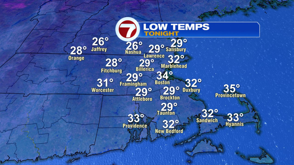
Tonight won’t be as cold, with temps in the upper 20s to mid 30s.
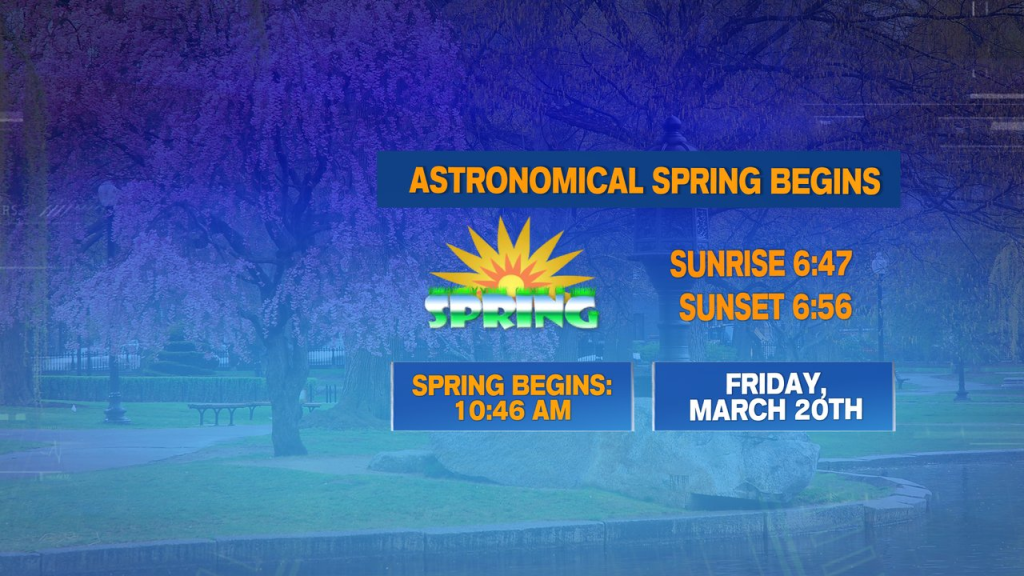
Astronomical Spring arrives tomorrow at 10:46AM.
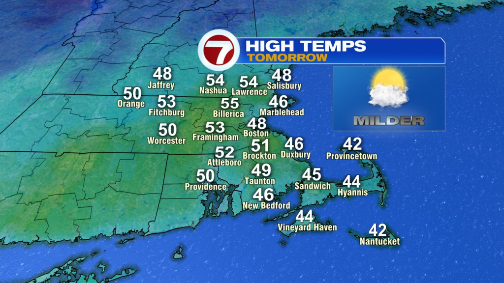
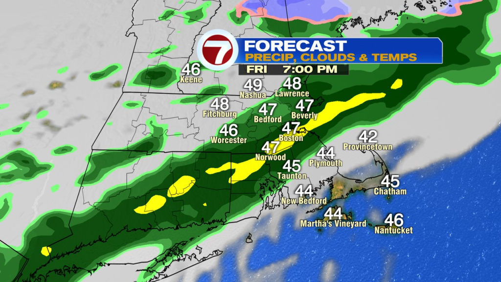
Right on cue, the numbers jump up tomorrow to 50-55 inland. Along the coast, we’ll run mid to upper 40s with an ocean breeze again. It’s a mainly dry day too with showers holding off until near day’s end. Those showers will likely move through during the evening, dampening the grounds for your Friday night plans.
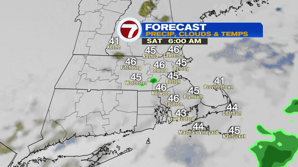
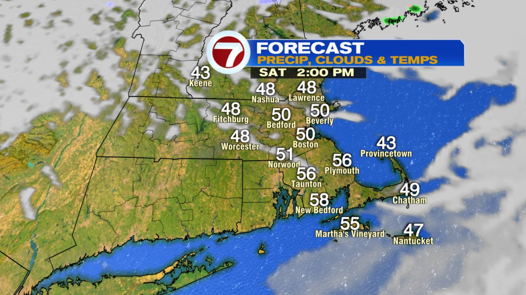
The weekend looks decent overall, not perfect, but we’ll find some milder air and a good amount of dry hours. Saturday starts with a lot of clouds and a few spotty early showers. By midday into the afternoon, clouds break for some sun and temps jump up into the low to mid 50s. Sunday will be milder, well into the 50s. While it’ll snow across far northern New England, it’ll take some time for the precip to get down here. The best shot of a few showers Sunday during the day in far northern Mass/NH. Otherwise most of the rain holds off until Sunday evening/night.
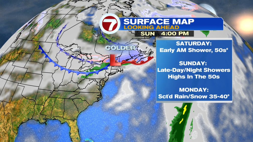
On the other side of the front, we’ll be much colder Monday with a few leftover rain/snow showers.
About the Author
Discover more from USA NEWS
Subscribe to get the latest posts sent to your email.


