
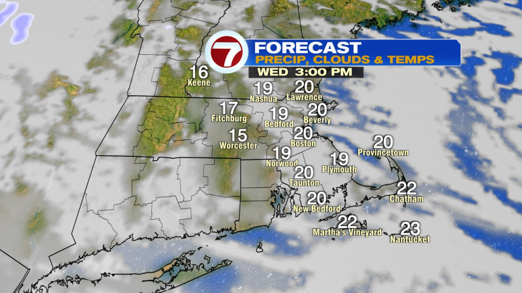
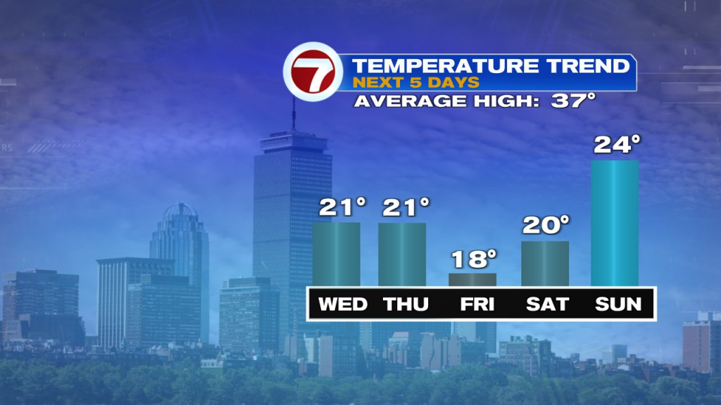
It’s a frigid start to the day as temps run near 0 in the colder burbs this morning. We’ll recover to near 20 this afternoon with partial sun. Ditto for tomorrow.
Thursday night through Friday night is even colder as lows dip below 0 for many and highs Friday only recover into the mid to upper teens.
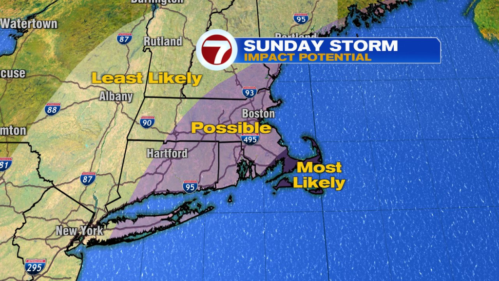
The cold holds into the weekend, but the big question is… do we get more snow?
While I’m confident that a strong coastal storm will form just off the Carolina/mid-Atlantic coast, where it forms exactly and how it tracks after, will determine how much of an impact we see, and there’s lower confidence in that, this far out.
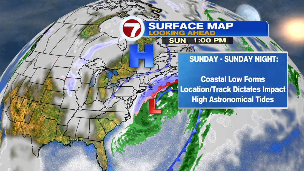
If the high over Canada is established far enough south and strong enough, it can suppress the storm south of us and not allow much of an impact here. However, if the low tracks just south of Nantucket, then it’s game on for a full on snow storm again, this time with even stronger winds/coastal flooding. Getting into the weeds of forecasting here, but you can see on this ensemble view (many different model simulations), the bunch of Ls (strong low pressure) just to our south, and then about half of them, well south and east and far enough away that precip wouldn’t make it in here.
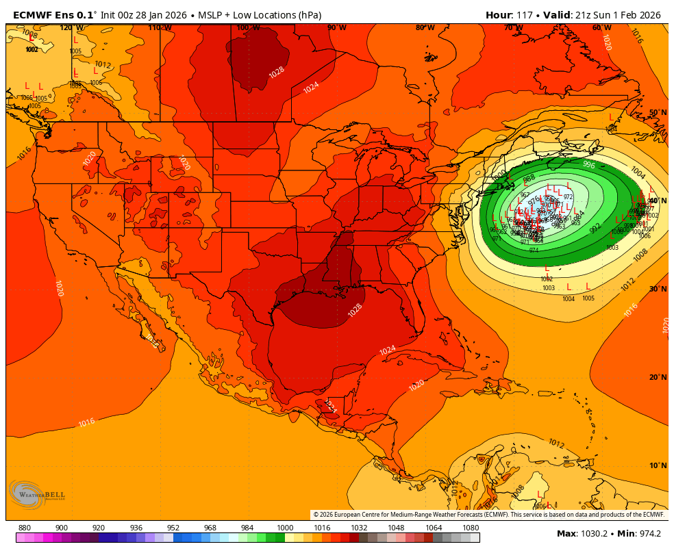
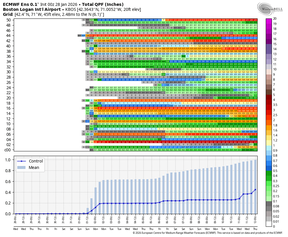
Below is another model look about all those Ls you see. It’s about a 50/50 split in bringing in a major storm vs. not much at all. What you’re looking at is the liquid equivalent of precip that falls, you can see about half the model runs spiking up precip Sunday into Sunday night. If we do get hit, that would be the likely timeframe.
The closer to the storm, the higher the risk of heavy snow and stronger winds. Below shows where the highest risk of 12″+ of snow is. It’s not a lock by any stretch, just a probability map showing the risks.
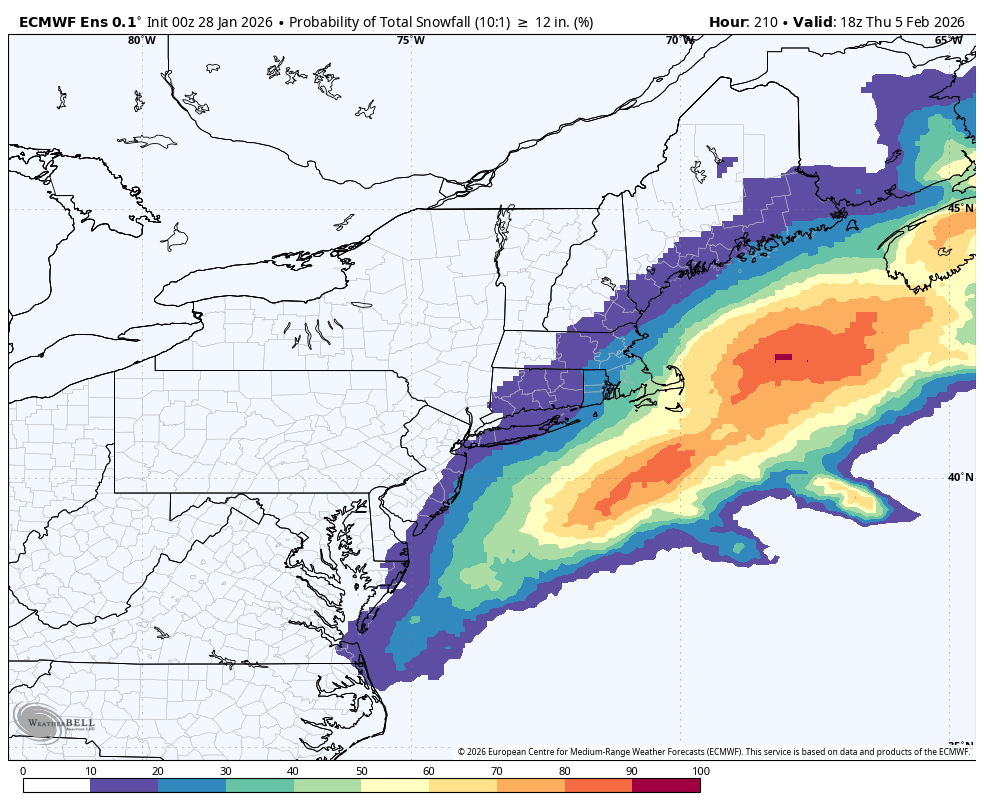
This go around, there will be a tremendous pressure difference between the high to our north and low to our south. That drive strong winds, especially across the Cape and Islands. Tides run astronomically high too, that’s why there’d be the increased risk of coastal flooding. The closer the storm, the higher the wind/flood risk at the coast.
Lots to watch closely over the next couple of days.
About the Author
Discover more from USA NEWS
Subscribe to get the latest posts sent to your email.


