
Happy Friday, April 10, 2026, South Florida!
Hopefully everyone has been enjoying the much-needed rain across the area. Of course, we could have done without the thunderstorms and the tornado in Palm Springs North on Tuesday but at least we got the rain that South Florida so very much needed. After a few soggy days across the area, the weather pattern will begin to change and even though we started the morning off with a few showers today, it is already evident that we are transitioning to a different type of pattern – a more enjoyable one!
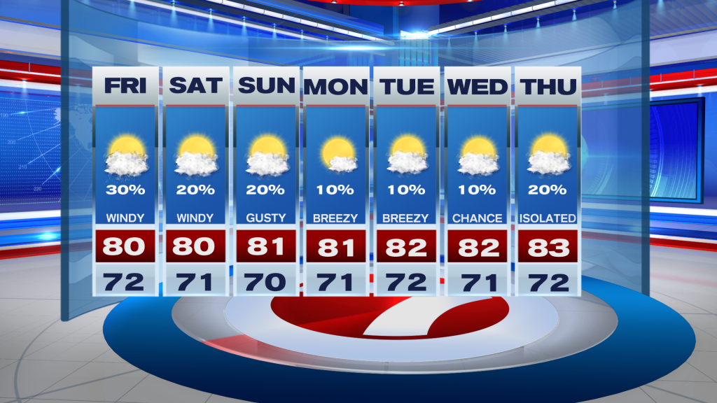
A front has remained stalled to the south of us through the last few days and its leftover moisture is what provided showers across the region. But now that the moisture continues to dissipate and high-pressure begins to build in from the north, not only will our wind pattern increase throughout the day today but will also notice drier air being ushered in by the Northeast winds around that area of high pressure. Afternoon high temperatures today will reach into the upper 70s to near 80° with a little more in the way of sunshine compared to previous days.
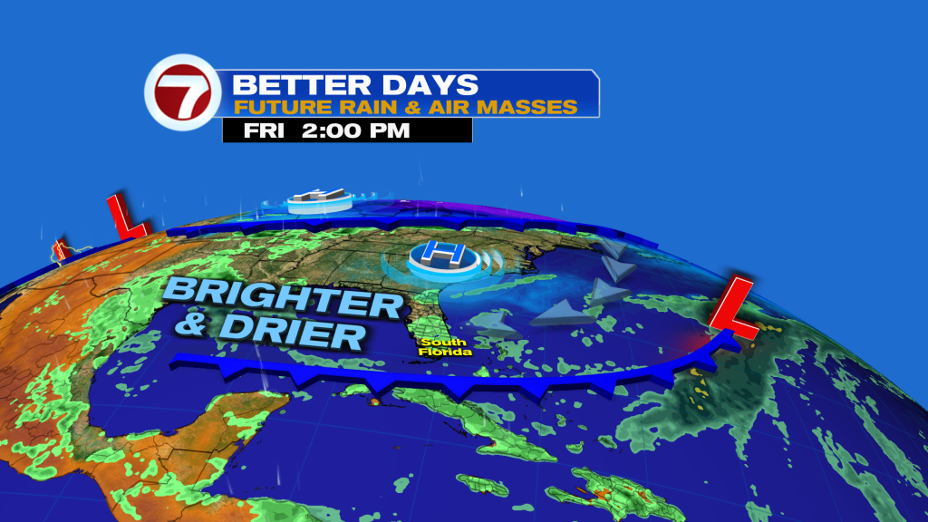
South Florida will remain lodged between low pressure to the south and a large area of high pressure to the north. This will keep windy to gusty conditions in place across South Florida through the upcoming weekend. And speaking of, the upcoming weekend is looking significantly drier and brighter than what we’ve seen so far this week. Wind gusts during this time will likely reach up to 35 mph at times. This will create dangerous beach and boating conditions through the start of next week. The breezy conditions continue into early next week. By the middle of the work week, wind speeds should begin to subside some as high-pressure finally moves farther into the Atlantic. And even with a distant high, it looks like South Florida will remain mostly dry not only for the weekend but also for much of next week.
Windy conditions this weekend will have a direct impact on our beach and boating conditions. A Small Craft Advisory has been issued for all South Florida waters as seas in the Atlantic could reach up to 6 to 9 feet. Higher seas expected along the Gulf Stream. Beach conditions will not be any better as the risk of rip currents will remain dangerously high all weekend long, prompting a few public beaches to shut down.
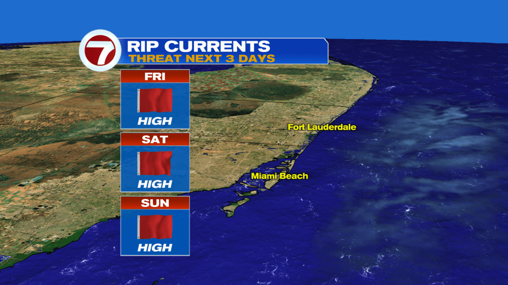
Enjoy the nicer weather this weekend. Please stay out of the water until winds subside!
Erika Delgado
Meteorologist
WSVN / ABC Miami
Copyright 2026 Sunbeam Television Corp. All rights reserved. This material may not be published, broadcast, rewritten or redistributed.
About the Author
Discover more from USA NEWS
Subscribe to get the latest posts sent to your email.


