
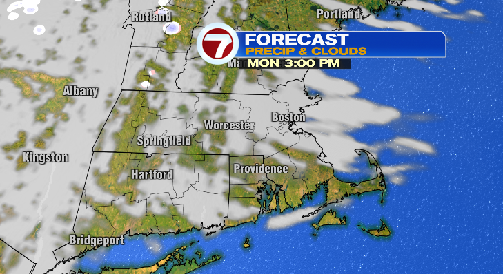
Happy Sunday! Happy Easter to all who celebrate. Unfortunately it was a wet one today, but we are tracking much drier skies ahead this week. At least for the most part.
Rain has already ended for most, but it’ll linger into southeastern Massachusetts into this evening. Overnight we’ll be dry and clouds will begin to move out, too. Lows will be chilly! Dress for the 30s as you head out the door Monday morning.
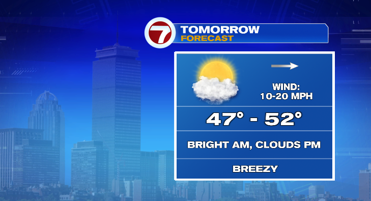
Monday starts bright but a few clouds will roll in as the day progresses.
Highs will reach the upper 40s and low 50s, and there will be a bit of a breeze at times. Still, better than the damp weather we had today!
Heads up for Tuesday! We’re watching the possibility of some early-morning rain and snow showers. At the very most we’re talking spotty coatings, but that could still be enough to lead to a few slick spots. Be extra careful!
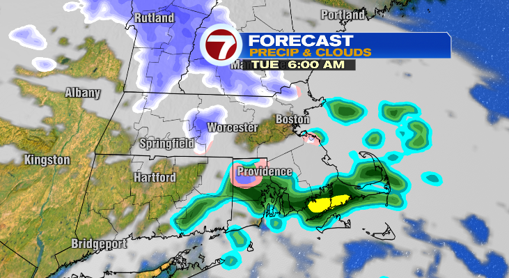
Tuesday morning starts near freezing but afternoon highs will reach the upper 40s. We could continue to see isolated rain or flurries the rest of the day. The sun will be out Wednesday! But it’ll be frigid in the morning. We’re talking the 20s to kick off the day with highs not making it out of the 40s.
Thursday: low of 30 with a high of 57 and partly sunny and breezy. Friday: sun/clouds and in the upper 60s in the afternoon. Next weekend looks fabulous! Some sun and more 60s. Stay tuned!
About the Author
Discover more from USA NEWS
Subscribe to get the latest posts sent to your email.


