
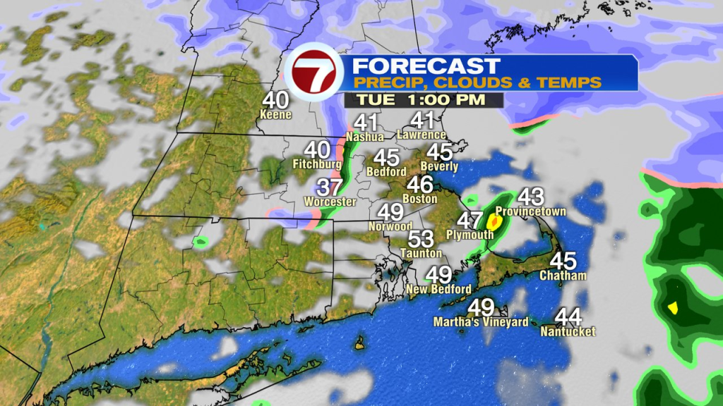
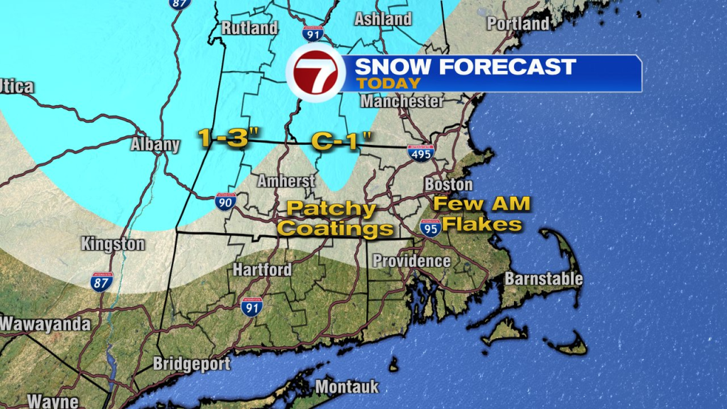
Anything and everything goes this time of year. In 1982, a blizzard that dropped over a foot of snow was wrapping up. In 2010, we hit a record high of 90 degrees. Today, while it’s nowhere near a blizzard, we do track some snow showers in the mix this morning as chilly air is in place. It won’t add up to much, but is certainly a reminder that Spring can struggle this time of year.
With temps near or above freezing, while the snow showers move through, other than some patchy coatings on the non-paved surfaces, I don’t expect much accumulation. By late morning/early afternoon, it’s just a few scattered rain showers left over. By day’s end, those scattered rain showers are offshore. With any breaks of sun in between the smattering of showers today, temps do jump up into the 40s to near 50, warmest across Southeast Mass.
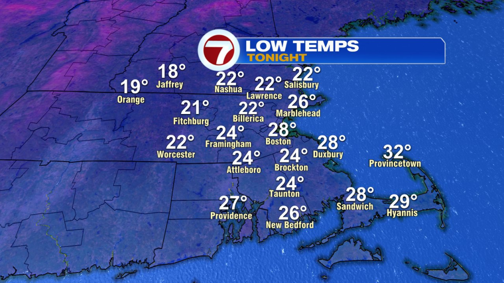
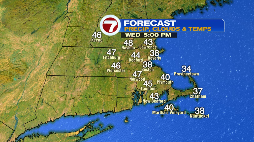
Temps fade fast tonight with clearing skies. Temps drop into the 20s. Factor in a breeze, and wind chills fade into the teens. Winter chill will be in the air for sure! The rebound tomorrow is decent with temps 45-50 away from the coast with wall and wall sunshine and light winds. At the coast, it’ll be chillier with a light ocean breeze holding temps down near 40.
The temp trend is up Thursday and Friday. By Friday, we’re well into the 60s and remain near 60 over the weekend. Other than a stray shower early Saturday morning, the pattern looks mainly dry Wednesday, through the weekend.
About the Author
Discover more from USA NEWS
Subscribe to get the latest posts sent to your email.


