
And just like that, the final full day of astronomical winter is wrapping up! While today’s temperatures were at least in the neighborhood of average, things will feel springier as the new season begins.
On that note, let’s start with this: the vernal equinox is at 10:46 AM on Friday morning, and with that, the new season will begin!
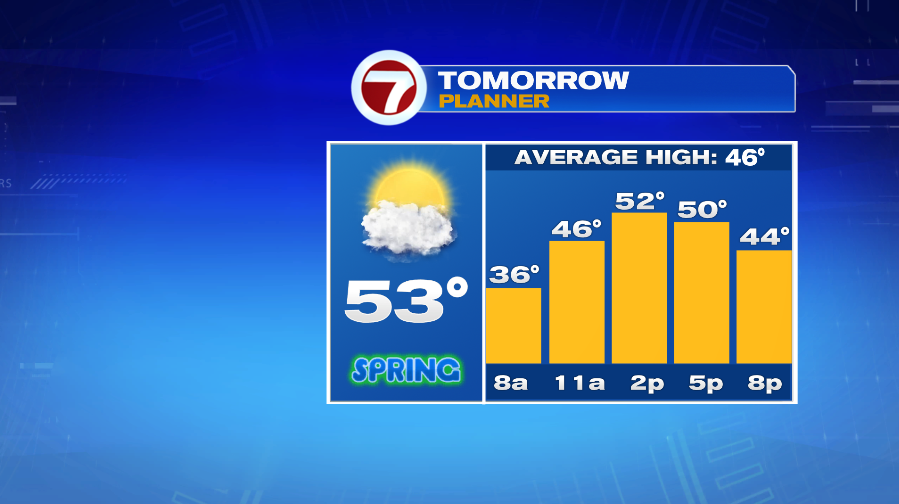
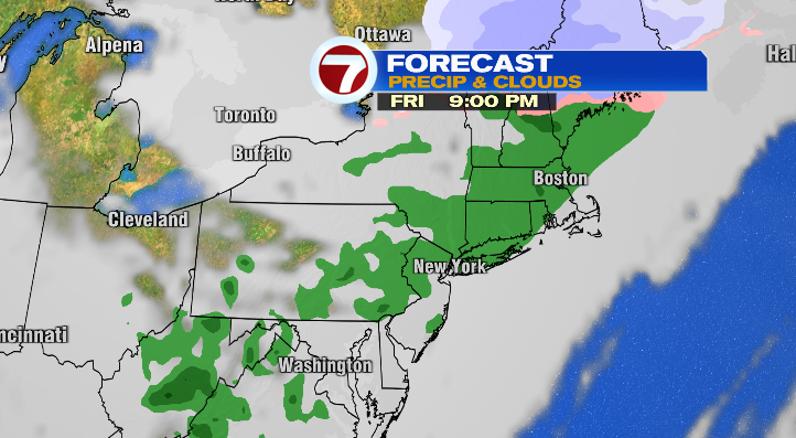
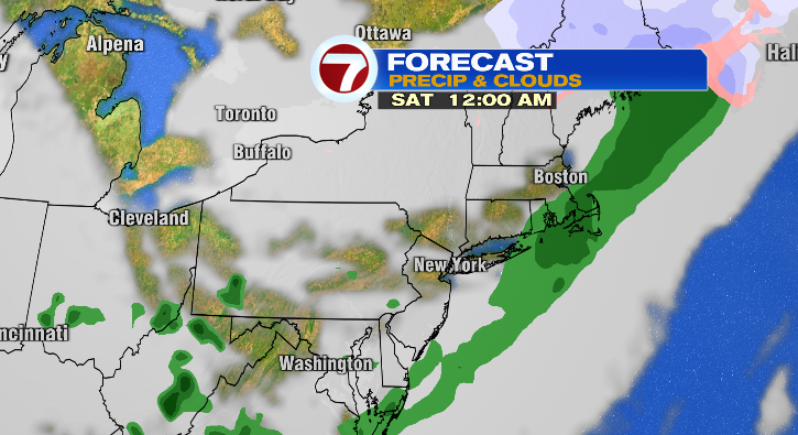
Spring will start with a mix of sun & clouds, as well as temperatures climbing into the low and mid 50s by the afternoon. Most of the day will stay dry, however, our next round of wet weather arrives Friday evening. Starting just before sunset (likely around 6 PM or so), we’ll see showers that will linger into early Saturday morning. It’ll be breezy during this time as well, with wind gusts in the 20s and 30s.
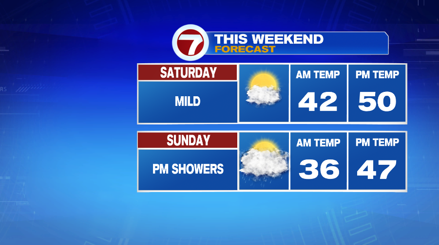
Timing is on our side with this rain, though, considering those showers fade in time for most of Saturday to be dry! It’ll stay breezy Saturday, but we’ll see more sunshine in the afternoon, and highs will be in the low 50s! Overall it’ll be a solid spring day to get outside.
Sunday also starts out dry, though clouds increase throughout the day (ahead of our next storm). Temperatures will be cooler Sunday with more clouds and showers that arrive in the afternoon. Initially, they’ll be isolated in the afternoon and become more widespread after sunset. The showers will continue into Monday with some mixing possible in the higher terrain.
Once these showers taper off, cold air settles back into Southern New England. Highs will only be in the upper 30s on Monday– a big swing from the above-average weekend highs. We’ll be sunnier Tuesday with what feels like a “repeat” pattern as highs will slowly rebound back to the low 40s.
About the Author
Discover more from USA NEWS
Subscribe to get the latest posts sent to your email.


