
It’s been a cool, cloudy, damp and dreary day this Wednesday all across South Florida but better weather is on the way!
Rainfall totals haven’t been impressive but some locations did manage to record more than a quarter inch of rainfall so far this Wednesday.
Throughout the overnight hours, some drier air will nudge in from the northwest, leading to dropping rain chances. Regardless, light rain and mist can be expected through at least the first half of the night.
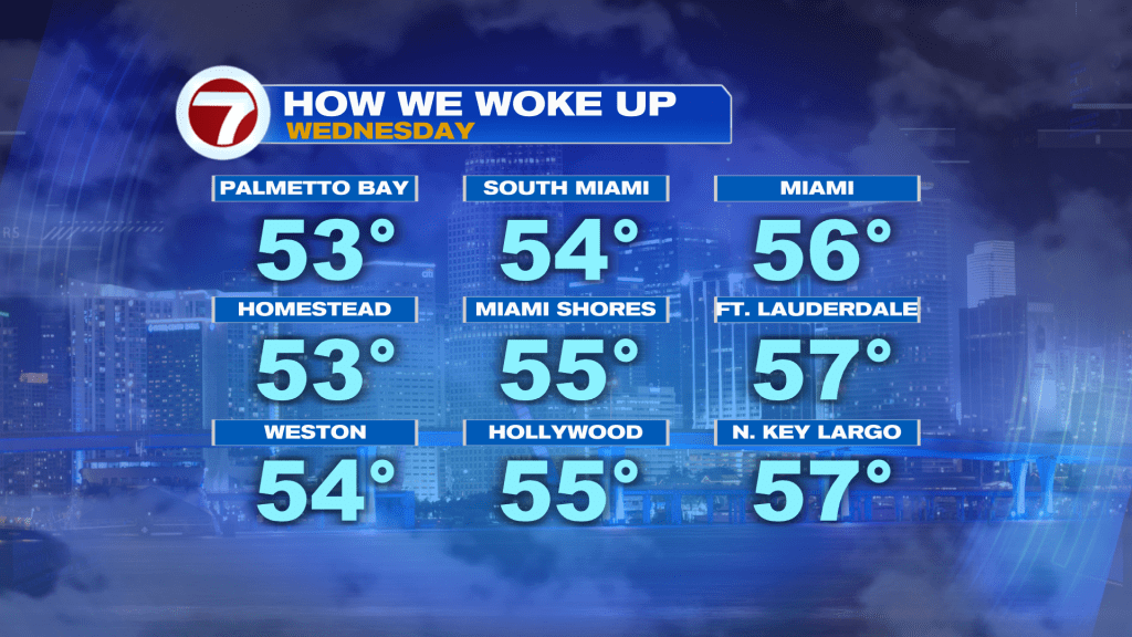
Temperatures will also be a touch milder with widespread lows in the low 60s opposed to the 50s, which was experienced this morning.
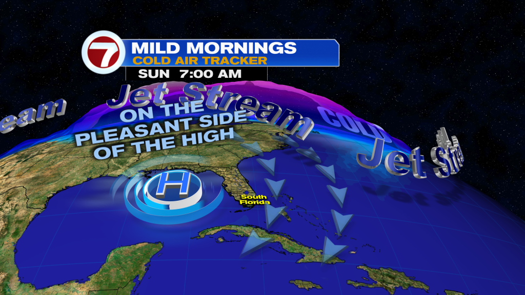
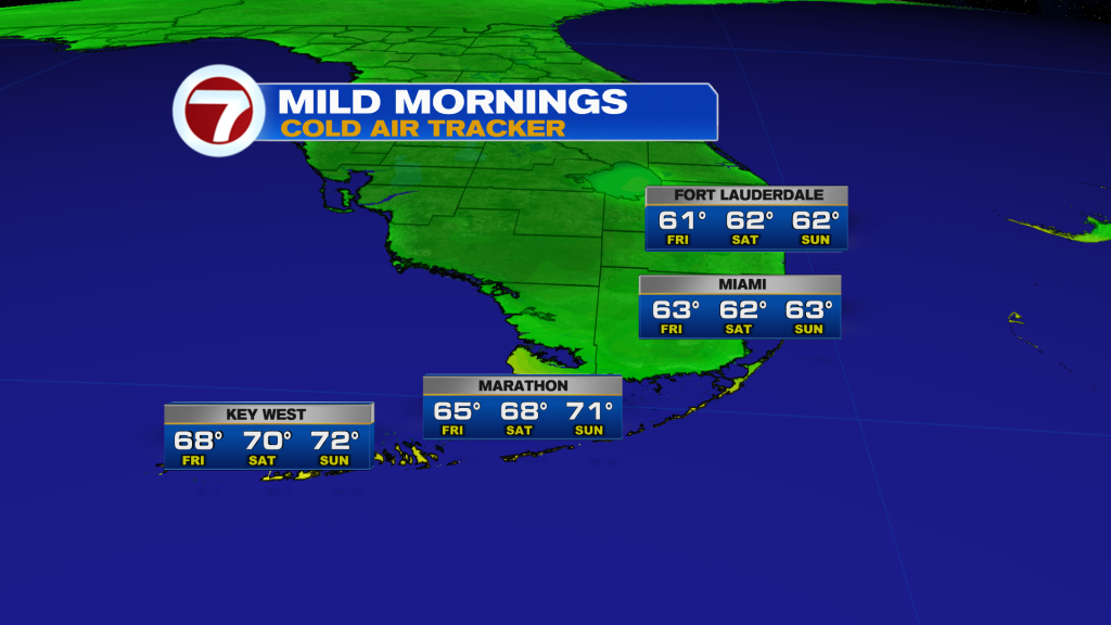
Future lows will also hold steady into the low to mid 60s through the weekend as we’ll stay on the cooler side of high pressure.
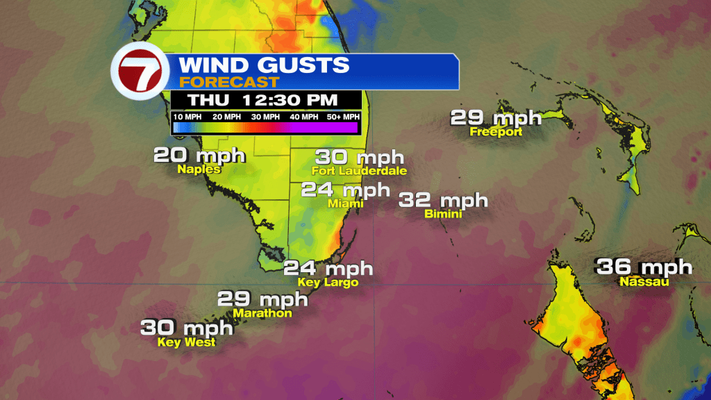
Thursday will be a much nicer day across the area. It will be brighter with intervals of clouds and sun. It will be warmer with highs in the upper 70s. And it will be quite windy with gusts up to 30 mph near the coast.
A spotty shower can’t be ruled out on Thursday, especially at the start and end of the day but most areas will avoid the rain.
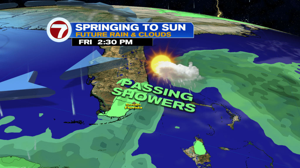
Now on Friday, a little bit of moisture does sneak back in with the northeast wind, which will still be strong, so some passing showers will remain possible. Otherwise, we’ll still see sunshine and experience comfortable conditions.
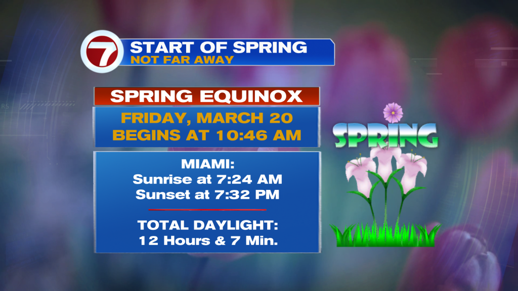
Friday is also the first day of spring, with the Spring Equinox occurring at 10:46AM.
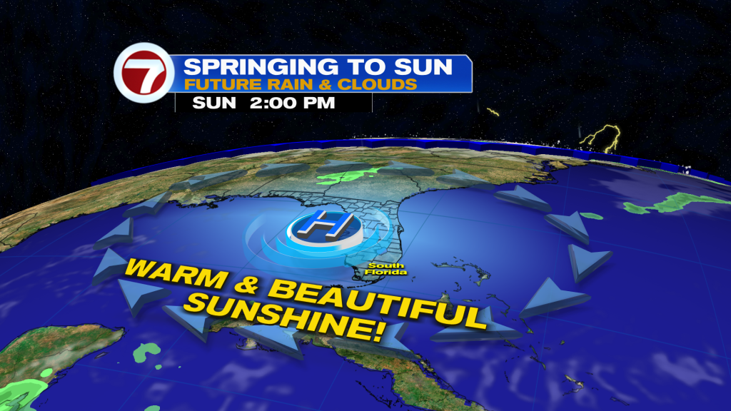
By the weekend and into early next week, the weather turns stunning! We’re looking at dry conditions, lots of sunshine and comfortably warm conditions. Highs will eventually rise into the 80s while humidity stays low.
Copyright 2025 Sunbeam Television Corp. All rights reserved. This material may not be published, broadcast, rewritten or redistributed.
About the Author
Discover more from USA NEWS
Subscribe to get the latest posts sent to your email.


