
It won’t be enough to fix the serious drought (south Florida) but we’re seeing the return of some rain this weekend. On Saturday, the rain “played favorites” with scattered areas in the afternoon. Here’s a look.
The unfortunate part, though, was that some of the rain came from strong thunderstorms with lightning and gusty winds. There was also a report (from a NWS employee) of pea size hail which pelted Palmetto Bay in the afternoon!
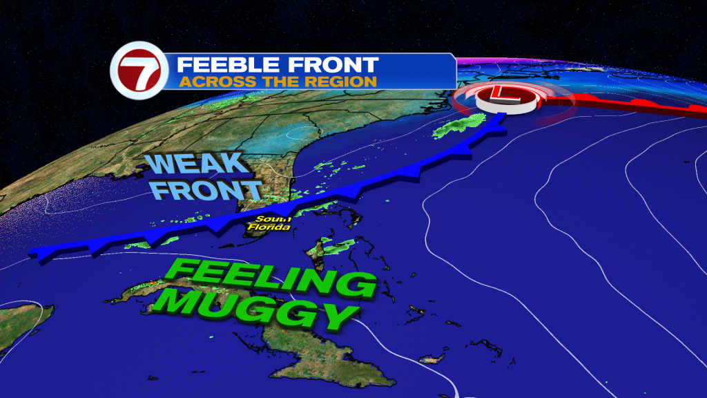
The instability is the result of warm and humid air merging with a Florida Front. The Cold Front has been slowly sagging south. There’s really no cooling coming with it (just the drop of about 5-degrees) and the boundary is forecast to dissipate over the next 24-hours. For Sunday, it’s the same type of weather setup with clouds increasing, mainly late-day, along with areas of rain that pop up.
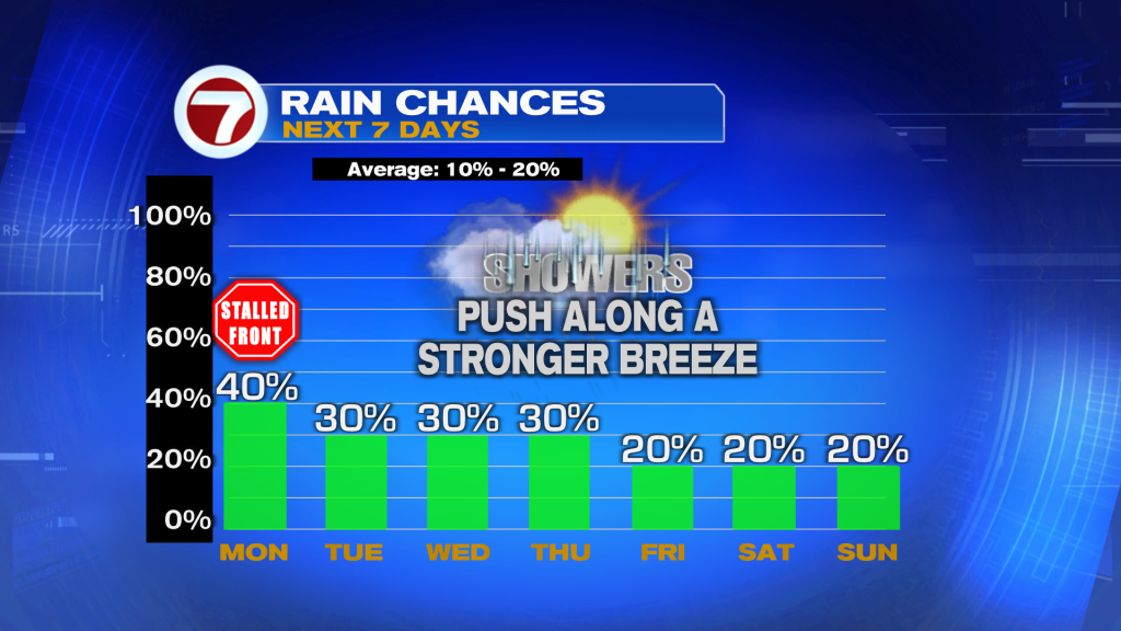
If you miss out on early week rain, there will be more opportunities. Throughout this first week of March, there will be isolated to scattered showers each day. Keep in mind, though, as winds pick up (late Monday) future rain bands will tend to bring even smaller and even faster showers off the ocean. That won’t allow for much accumulation. Just the same, it would be wise to keep your umbrella handy and be ready to encounter some fly-by showers, at times.
Copyright 2025 Sunbeam Television Corp. All rights reserved. This material may not be published, broadcast, rewritten or redistributed.
About the Author
Discover more from USA NEWS
Subscribe to get the latest posts sent to your email.


