
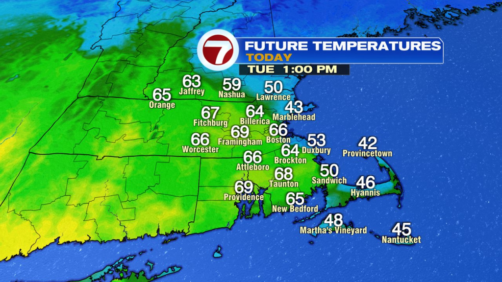
After temps reached the 60s and low 70s yesterday, it’ll be mild again today, at least to start. Showers move through this morning and have a tendency to become few and far between midday, into this afternoon.
The challenge this afternoon will be the temperature forecast as a back door cold front moves in from the northeast. That’ll provide a dramatic drop off in temps when it swings on through. It’ll start midday around the NH Seacoast to Cape Ann, and then drop west to southwest. You can see the progression below. While it won’t be exact to the hour, it gives the general theme of how it plays out.
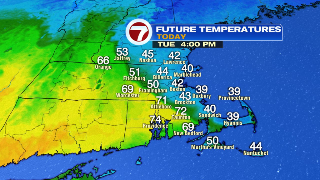
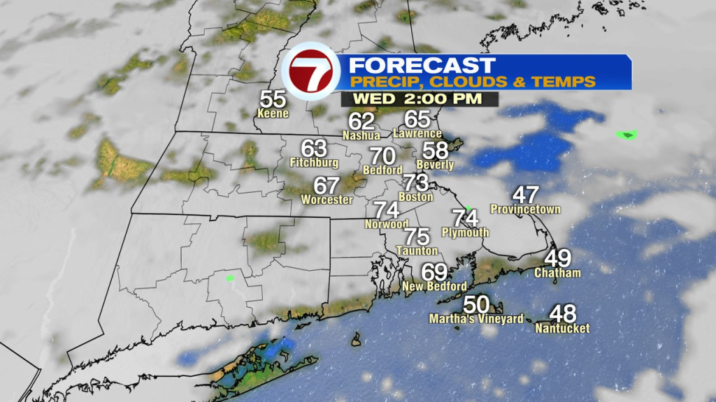
Most of us cool back into the 40s by this evening with overnight scattered showers and storms as the front tries to move back to our northeast, providing for milder air again on Wednesday. Wednesday’s temps near 70, at least away from Northeast Mass, where the cooler air may hang on.
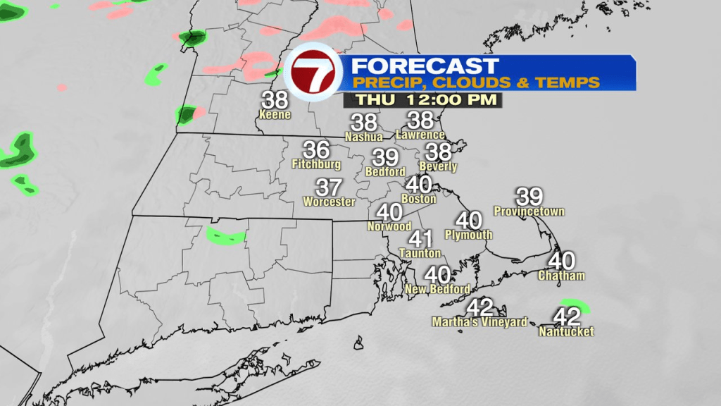
Wednesday evening, the front then moves back through for all and winds shift to the northeast again. It’ll be a chilly and raw feel to the air as temps hover around 40 all day Thursday.
Friday morning starts cool with patchy fog/drizzle, but midday improvements feature the wind turning back south and some breaks of sun arriving. That’ll send afternoon temps into the 60s to low 70s, warmest inland. That means decent weather arrives just in time for the home opener at Fenway!
About the Author
Discover more from USA NEWS
Subscribe to get the latest posts sent to your email.


