
Saint Patrick’s Day is a couple days away — on Tuesday — and the radar is expected to show some green as showers will be possible.
Even before then, green is more likely on the radar picture both today and tomorrow ahead of a stronger front, which arrives Monday night.
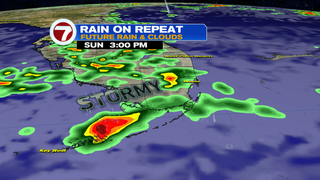
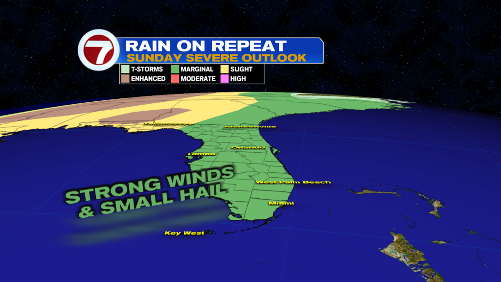
Showers and storms are more likely on Sunday compared to yesterday as a disturbance moves through late in the day, adding a better trigger for storm development while pushing it toward the east coast.
This will also fuel the risk for isolated severe storms, including the threats for damaging winds and small hail. Where any heavy rainfall sets up, flooding will also be a possibility.
Sunday won’t be a washout but the morning will be the best timing to get any of your outdoor plans before scattered to numerous showers and thunderstorms are expected to move in throughout the afternoon.

Then overnight, clouds will gradually clear with mostly dry conditions and a beach breeze keeping temperatures warm.
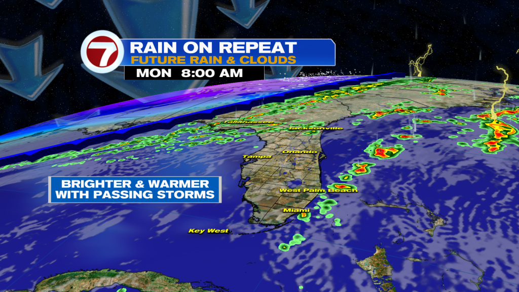
Monday is poised to be warmer with highs surging into the mid to potentially upper 80s. Expect to see additional sunshine at times Monday but also rounds of passing showers and storms throughout the day.
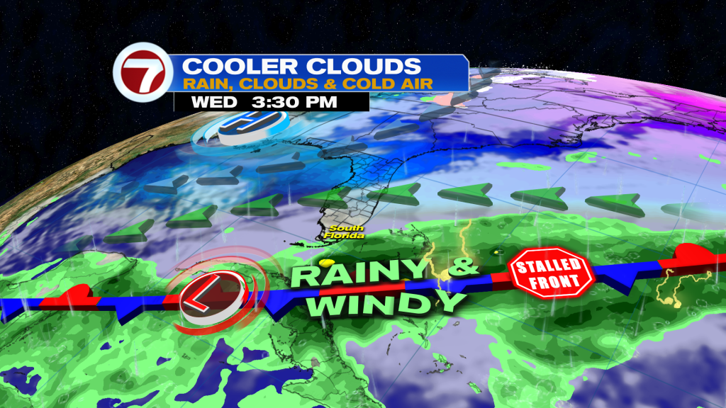
That’s in advance of the aforementioned front. Despite the front clearing to our south on Tuesday, it’s going to sock us in with the clouds and times of rain as moisture lags behind this front.
Therefore, expect the chance for showers, especially across the Florida Keys, on Saint Patrick’s Day. Otherwise, it will be cooler and breezy.
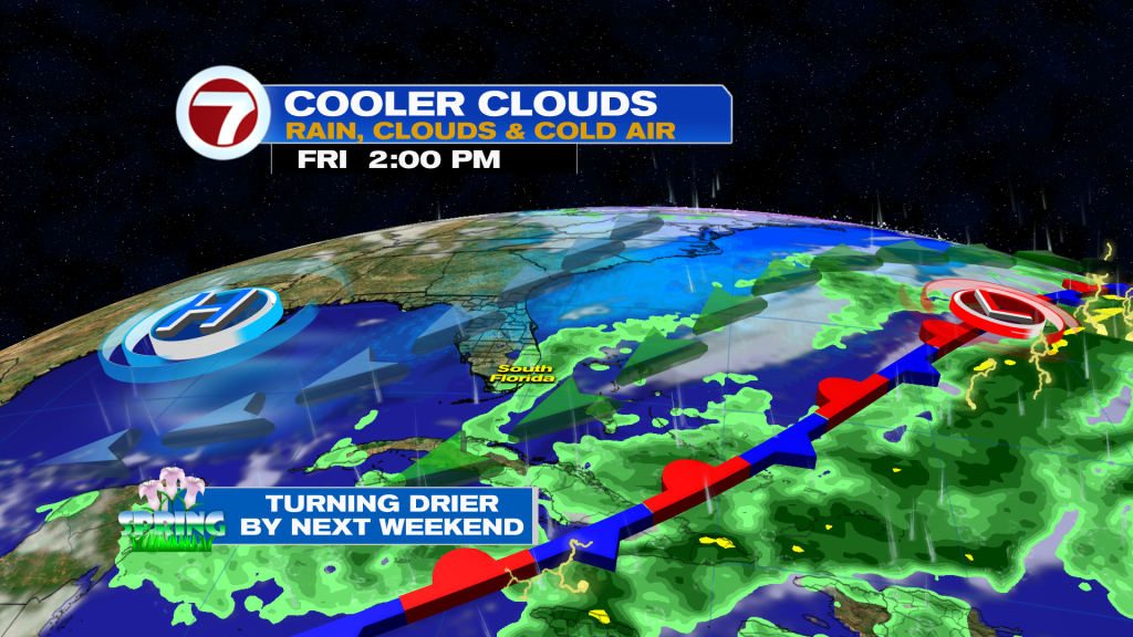
Then on Wednesday into Thursday, South Florida will be positioned right on the edge of moisture as low pressure forms along the now-stalled front to our south. Therefore, rainy conditions are possible, once again favoring southern locations. Both days will be mild, windy and generally cloudy regardless.
It’s not until the first day of spring on Friday when we should finally transition out of this active pattern for dry season standards!
About the Author
Discover more from USA NEWS
Subscribe to get the latest posts sent to your email.


