
It sure has been a gorgeous week across South Florida with lots of sunshine, dry conditions and pleasantly warm temperatures. All good things must come to an end and that will be the case by the end of this upcoming weekend when rain and strong winds return.
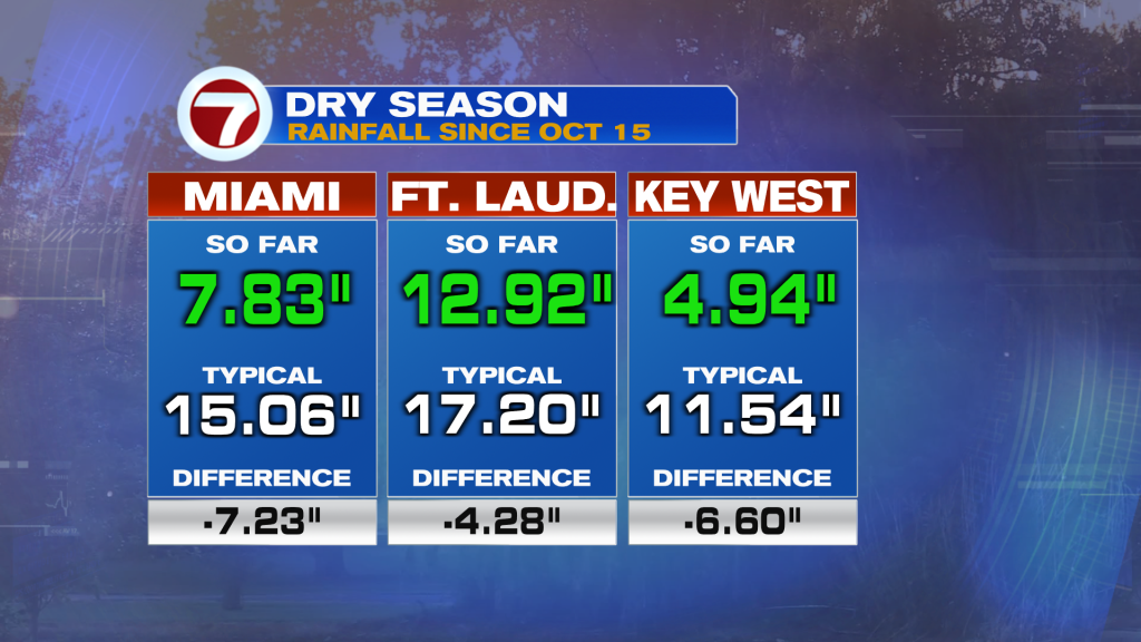
We are greatly in need of rain. The new drought monitor released this morning shows no change from last week’s update.
Dry season, which began on October 15, has been in a multi-inch deficit, especially across mainland South Florida.
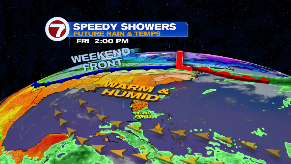
Rain chances will start to creep up Friday and especially for early next week. With a bit more moisture in place Friday paired with an onshore breeze, expect isolated morning showers followed by afternoon sunshine and mostly dry conditions. High temperatures will reach the low to mid 80s.
Saturday will be fairly similar overall with an isolated rain chance and plenty of dry time, although as a front nears from the north, rain chances will start to rise Saturday evening. As a result, scattered showers along the building breeze out of the northeast are possible.
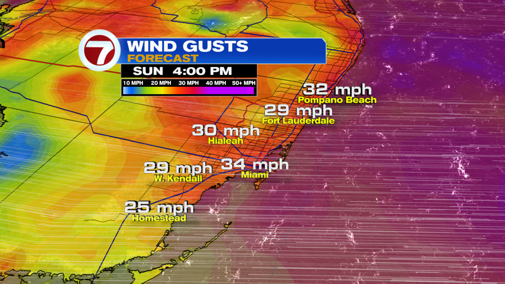
Then on Sunday, this will be the uglier half of the weekend. It will be wet and windy with scattered to numerous showers and downpours blowing onshore along the stalling front. Expect wind gusts to top 30-35 mph in the afternoon.
It certainly can be a washout, which may end up making for a soggy end to the Ultra Music Festival.
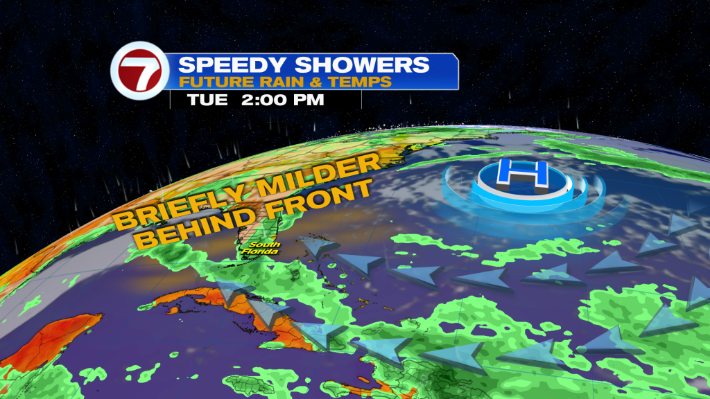
Even into Monday, moisture and the strong winds are expected to linger, so scattered showers remain possible. Given the clouds and rain, temperatures should be milder Sunday into Monday.
It’s not until Tuesday and beyond when drier conditions and better weather should return.
About the Author
Discover more from USA NEWS
Subscribe to get the latest posts sent to your email.


