
SAN FRANCISCO (KGO) — It’s going to be a wet Christmas this week in the Bay Area.
LIVE UPDATES: Storms flood parts of NorCal with heavy rain as alerts expand to entire Bay Area
LIVE: Track rain in San Francisco Bay Area with Live Doppler 7
A stronger storm Tuesday night into early Wednesday will bring heavy showers and a high threat for damaging winds across the Bay Area.
ABC7 meteorologist Drew Tuma has a timeline for the storm this week below.
VIDEO: Watch the latest AccuWeather forecast
Monday
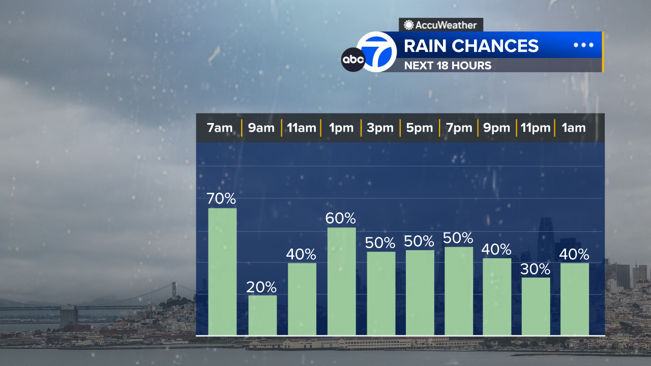
We will be at a level 1 on the ABC7 Exclusive Storm Impact Scale all day Monday for scattered showers
The biggest impact will be slick and slow travel with standing water on roads.
Rainfall totals will be less than .50″.
Winds will be light — less than 20 mph.
Tuesday and Wednesday
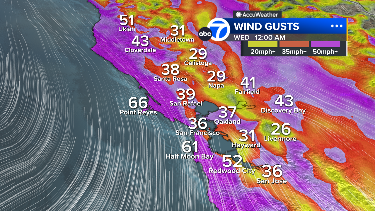
8 p.m. Tuesday through 4 a.m. Wednesday we will be at a level 3 on the ABC7 Exclusive Storm Impact Scale.
During this eight-hour window, we could see winds in excess of 60 mph. A High Wind Watch is in effect.
The strongest winds will be along the coast in our hills of the North Bay and East Bay.
There’s a high potential for trees to come down along with power outages.
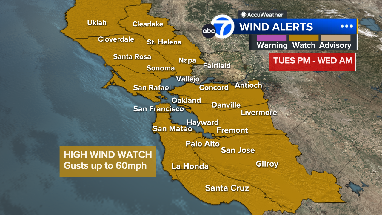
Winds will dramatically shut off around 4 a.m. Wednesday leading to calmer conditions for the rest of the morning.
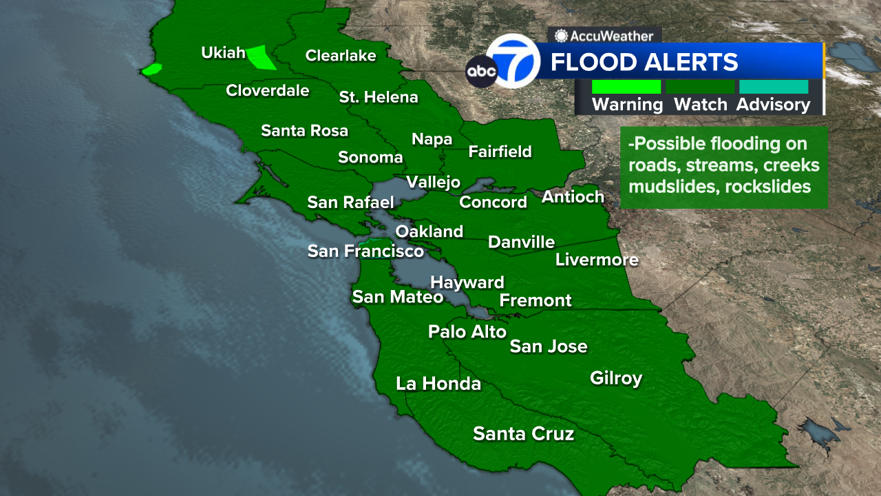
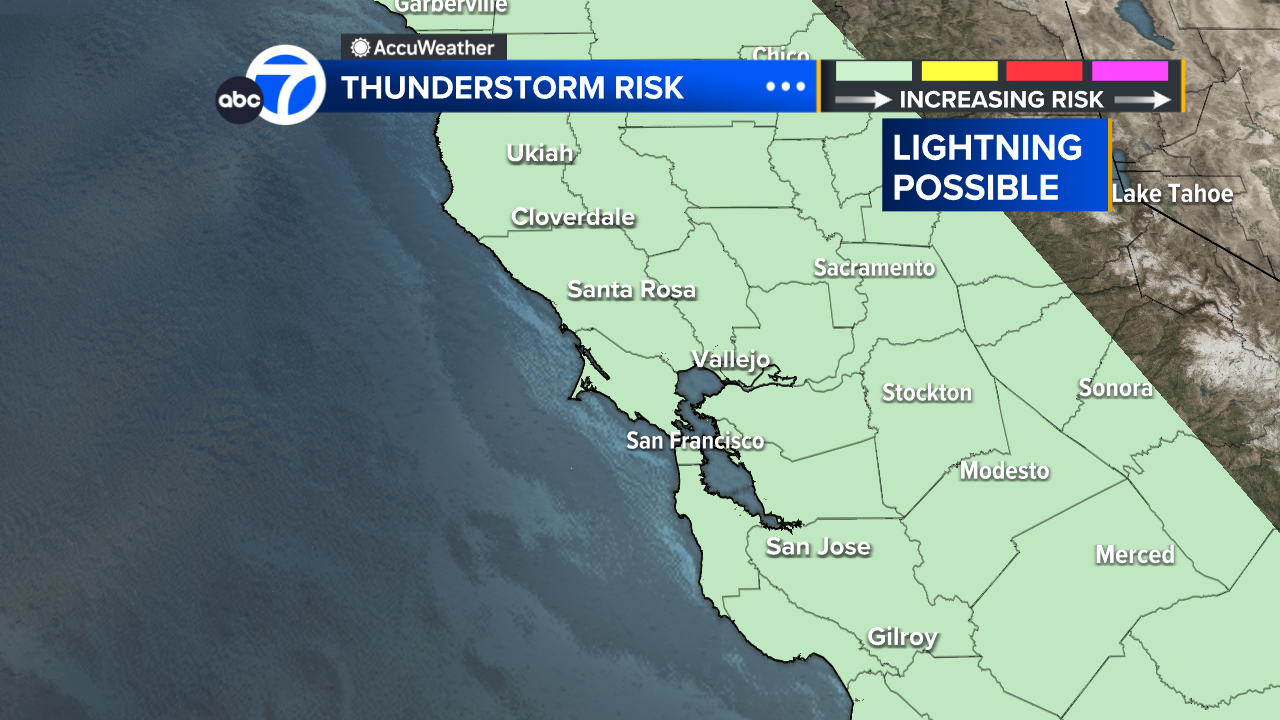
A Flood Watch is also in effect for the entire Bay Area for the potential for more roadway flooding due to thunderstorms.
App users: For a better experience, click here to view the full map in a new window
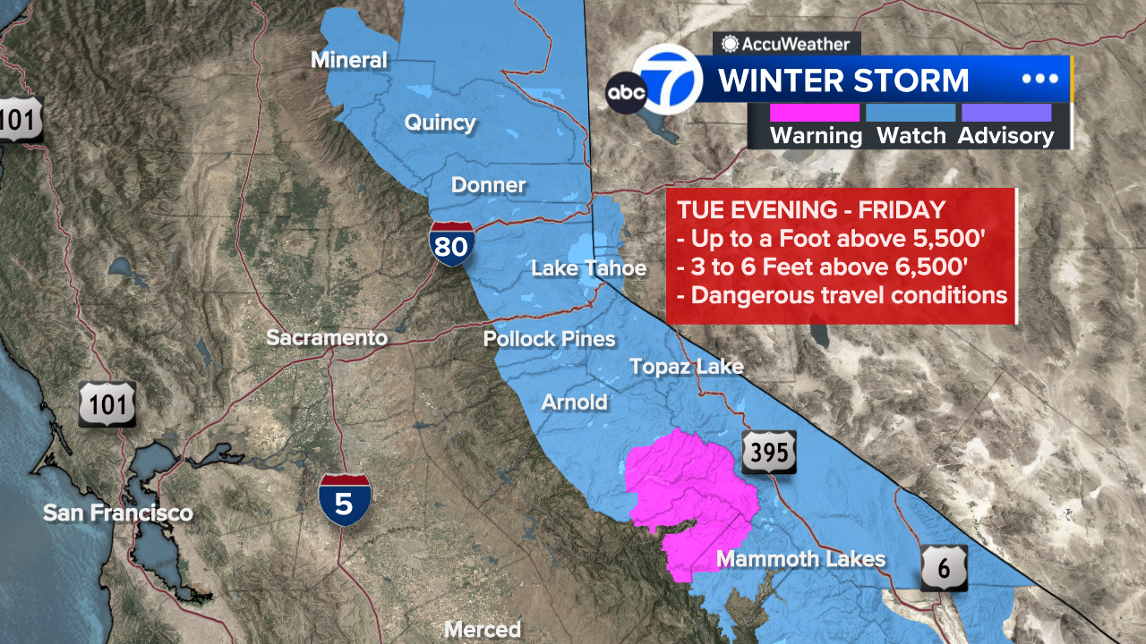
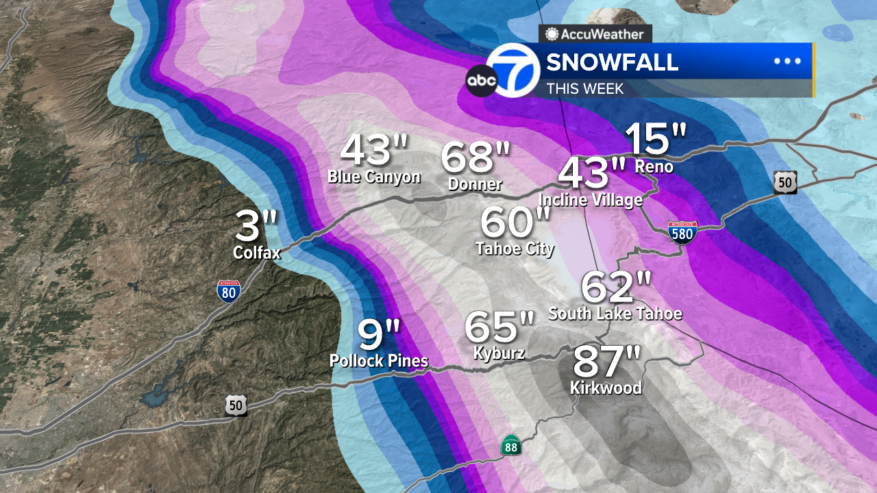
Sierra Snow
There will be significant Sierra Snow on Christmas Eve and Day that will create major travel impacts.
Heavy snow begins in the morning Christmas Eve and remains heavy through Christmas night.
Get to Tahoe by Tuesday evening to avoid travel headaches.
There’s an estimated 3 to 6 feet of new snow coming to the Tahoe resorts.
A Winter Storm Watch is in effect Tuesday through Friday.
Copyright © 2025 KGO-TV. All Rights Reserved.
About the Author
Discover more from USA NEWS
Subscribe to get the latest posts sent to your email.


