
Pleasant weather is here and we shouldn’t take it for granted, south Florida.
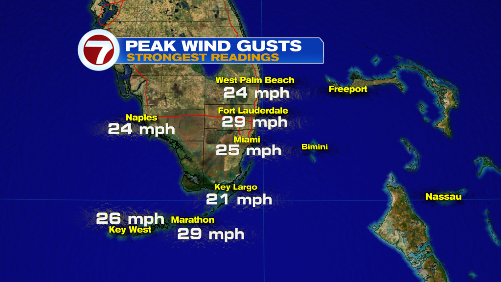
A persistent feature of our recent weather has been gusty winds, at times.
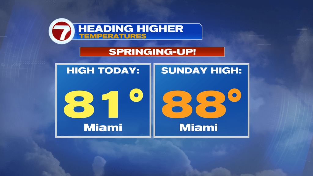
Wind speeds aren’t heading higher, but temperatures are likely to ramp over time. Here’s a comparison between Wednesday’s high (officially in Miami) and the forecast high for Sunday.
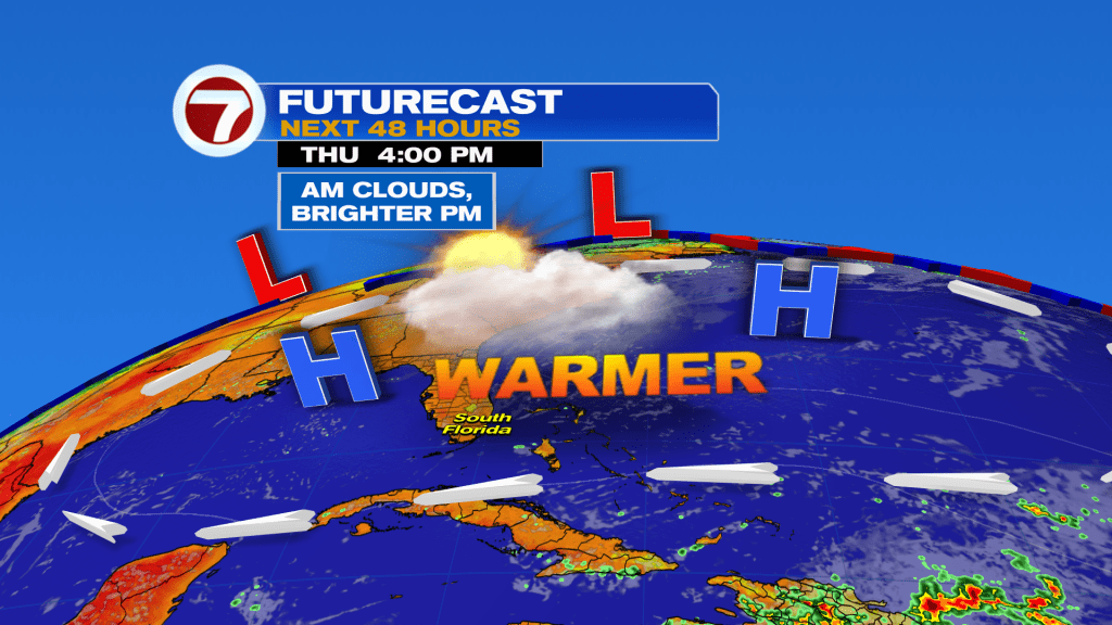
Before that, Thursday’s weather map is shaping up nice and looks, well, very familiar.
This pattern of extensive High Pressure (whether you like it, or not) isn’t going to hold. In fact, as the High fades away, the forecast calls for a Cold Front to move into Florida early next week.
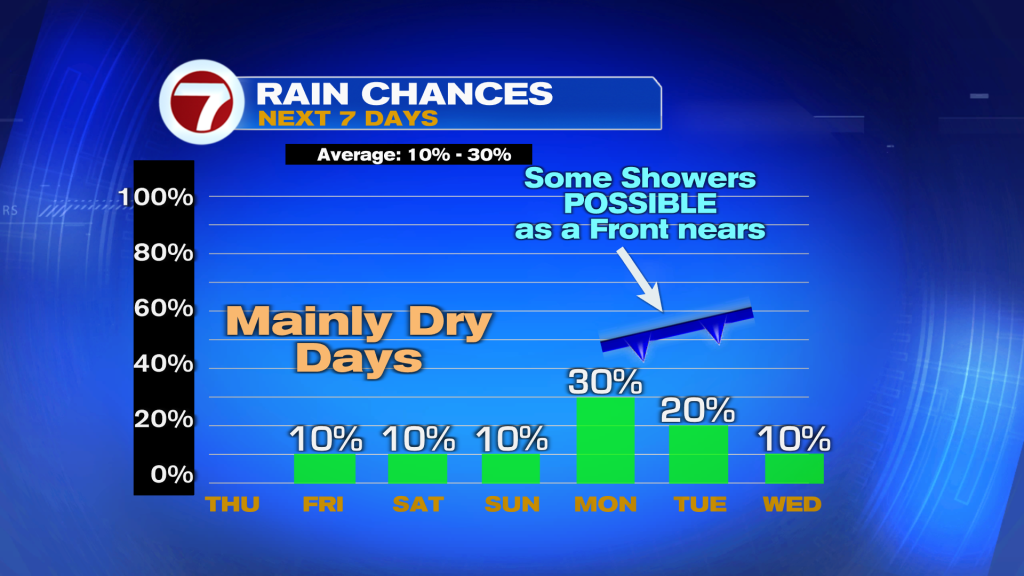
Notice, above, the chance for rain showers will increase with the Front near us, early in the week. At this point, we’re going with the thinking (as per forecast models) that the boundary will cross on Monday. That would typically lower chances after its passage. If, though, the Front would weaken and stall, we’d probably have multiple days of scattered showers, at least. Stay tuned.
Copyright 2026 Sunbeam Television Corp. All rights reserved. This material may not be published, broadcast, rewritten or redistributed.
About the Author
Discover more from USA NEWS
Subscribe to get the latest posts sent to your email.


