
South Florida is heading into a stretch of hot and mostly dry weather, but there are a few things to watch—especially early today and as we head into the weekend.
This morning, smoke from the Hwy 41 wildfire may drift into parts of the Miami metro, leading to reduced air quality and visibility.
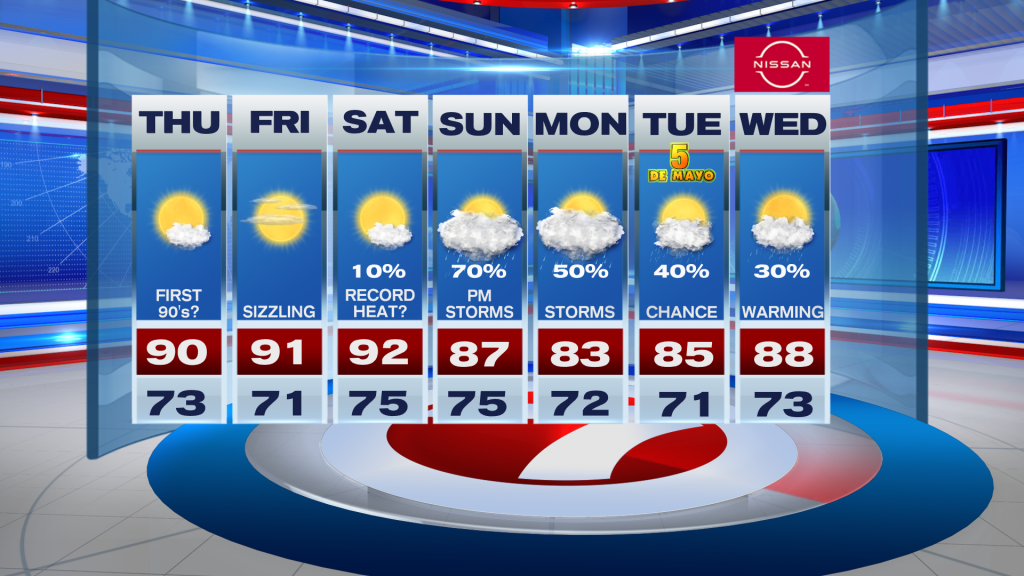
Once the morning haze clears, the focus shifts to the heat. Dry conditions will hold through Friday, with highs climbing into the upper 80’s and low 90’s, and even hotter inland. This is well above average for this time of year.
By Saturday, the heat peaks. A southerly breeze will help temperatures surge into the low to mid 90’s, with some inland spots possibly even hotter. When you factor in humidity, it will feel like the low 100’s in places. Heat risk is increasing, especially across the East coast metro, so it’s important to stay hydrated and limit time outdoors during peak heat.
Looking ahead, changes arrive late in the weekend. A front approaching from the North will bring back higher chances for showers and thunderstorms starting Sunday, with unsettled weather potentially lingering into early next week.
Have a wonderful day South Florida and make it a safe one!
Vivian Gonzalez
Meteorologist, AMS Certified
WSVN Channel 7
About the Author
Discover more from USA NEWS
Subscribe to get the latest posts sent to your email.


