
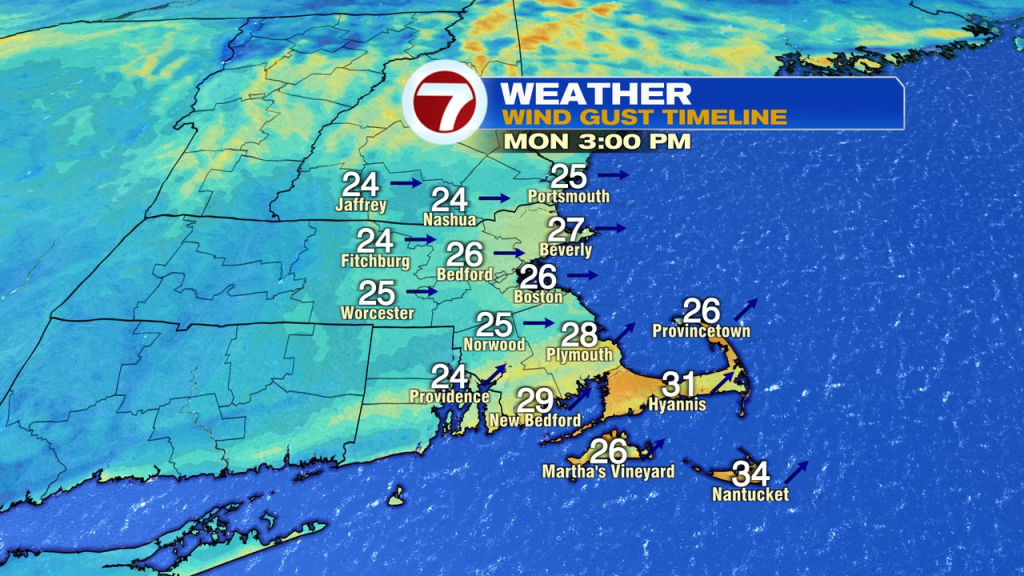
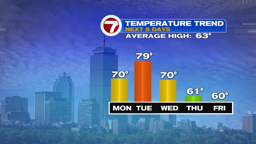
We’ll shake off the weekend chill today as a west to southwest wind kicks in milder air and sunshine. Highs this afternoon will top off near 70 for many, away from the south coast. The breeze will be busy, gusting 25-35mph.
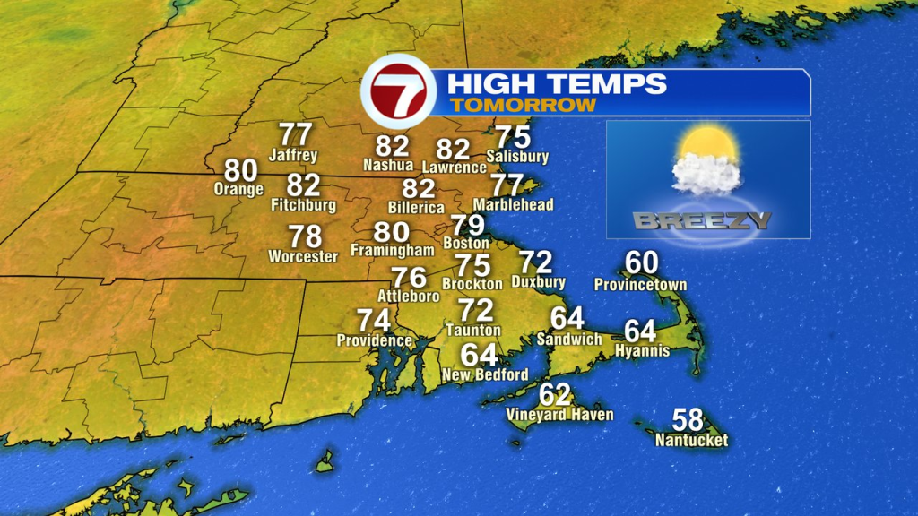
The breeze is pretty much right there again tomorrow in the 25-35mph range, out of the southwest. This time, we’ll add another 10 degrees onto highs near and north and west of Boston. That’ll push highs close to 80 for many! Although, it’ll be much cooler near the south coast again.
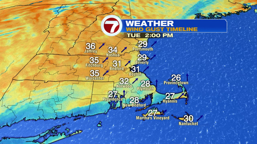
Wednesday is still mild, but not as warm as mostly cloudy skies hold highs in the 60s to around 70. Winds are still active, gusting over 30mph out of the south to southwest. Showers advance in late afternoon and become more widespread in the evening and overnight. We’ll track some rumbles of thunder and embedded downpours Wednesday night.
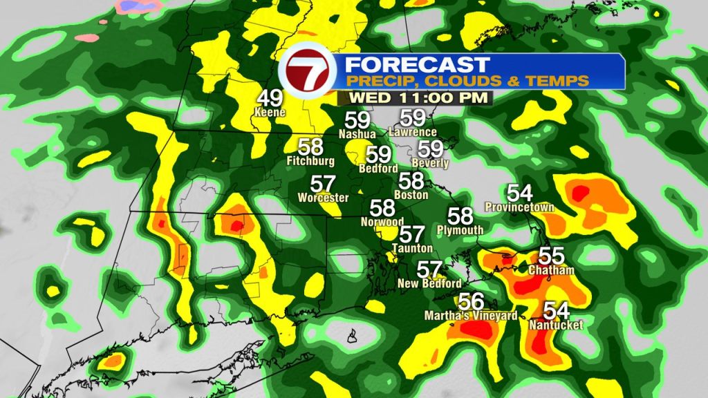
Rain tapers from northwest to southeast Thursday morning.
That’ll leave most of the time from Thursday afternoon, right through the weekend, seasonable cool, but featuring a lot of dry hours. At some point over the weekend, a few spotty showers are possible, most likely Saturday afternoon or night. Another system will bring rain near the end of the weekend, but most of it is slated to arrive late Sunday night, if not Monday, leaving most of Mother’s Day dry.
About the Author
Discover more from USA NEWS
Subscribe to get the latest posts sent to your email.


