
Sunday’s snowstorm brought 2 to 6 inches of snow across most of the region. Steady snowfall has ended, but light snow showers and flurries may linger through Monday morning.
The D.C. area woke up to a fine coating of snow and slush Monday morning.
Sunday’s snowstorm brought 2 to 6 inches of snow across most of the region. Steady snowfall has ended, but light snow showers and flurries may linger through the morning hours.
High temperatures will reach around 40, but wind chills will remain below freezing all day.
“We didn’t get the big totals that we expected across the area, but the snow is done,” said WTOP Meteorologist Lauryn Ricketts.
But the impacts of the storm continue.
“What’s not over is the winds. Gusty winds of up to 35 to 40 mph throughout the day and into Tuesday morning.” Ricketts said.
Expect sunshine Tuesday, with temperatures climbing into the upper 30s to near 40. The wind will settle down by midmorning and into the afternoon. Until then, the D.C. region will be dealing with gusts of 35 to 40 mph out of the northwest.
These winds can lead to power outages and downed tree branches.
Maryland has declared a state of emergency, authorizing snow removal protocols and shifting to storm management practices. Emergency protocols are in place for Montgomery and Prince George’s counties.
(WTOP/ Neal Augenstein)

(WTOP/ Neal Augenstein)
(WTOP/Luke Lukert)

(WTOP/Luke Lukert)

(WTOP/Giang Nguyen)

(WTOP/ Giang Nguyen)
Snow impacts region hard
In Loudoun County, Virginia, the snow moved away from the area early Monday morning, but it’s still affecting morning commutes. About 2-3 inches of snow fell in eastern portion of the county.
Main commuter routes are clear of snow, as crews are busy salting and sanding the remaining roads
“As you leave your house, be aware that it may take several minutes to clear what fell overnight because the wet snow has now turned to ice,” WTOP’s Neal Augenstein reported. “Utilize your car’s heater and defroster to melt the ice and make sure you clean off the roof of your car too.”
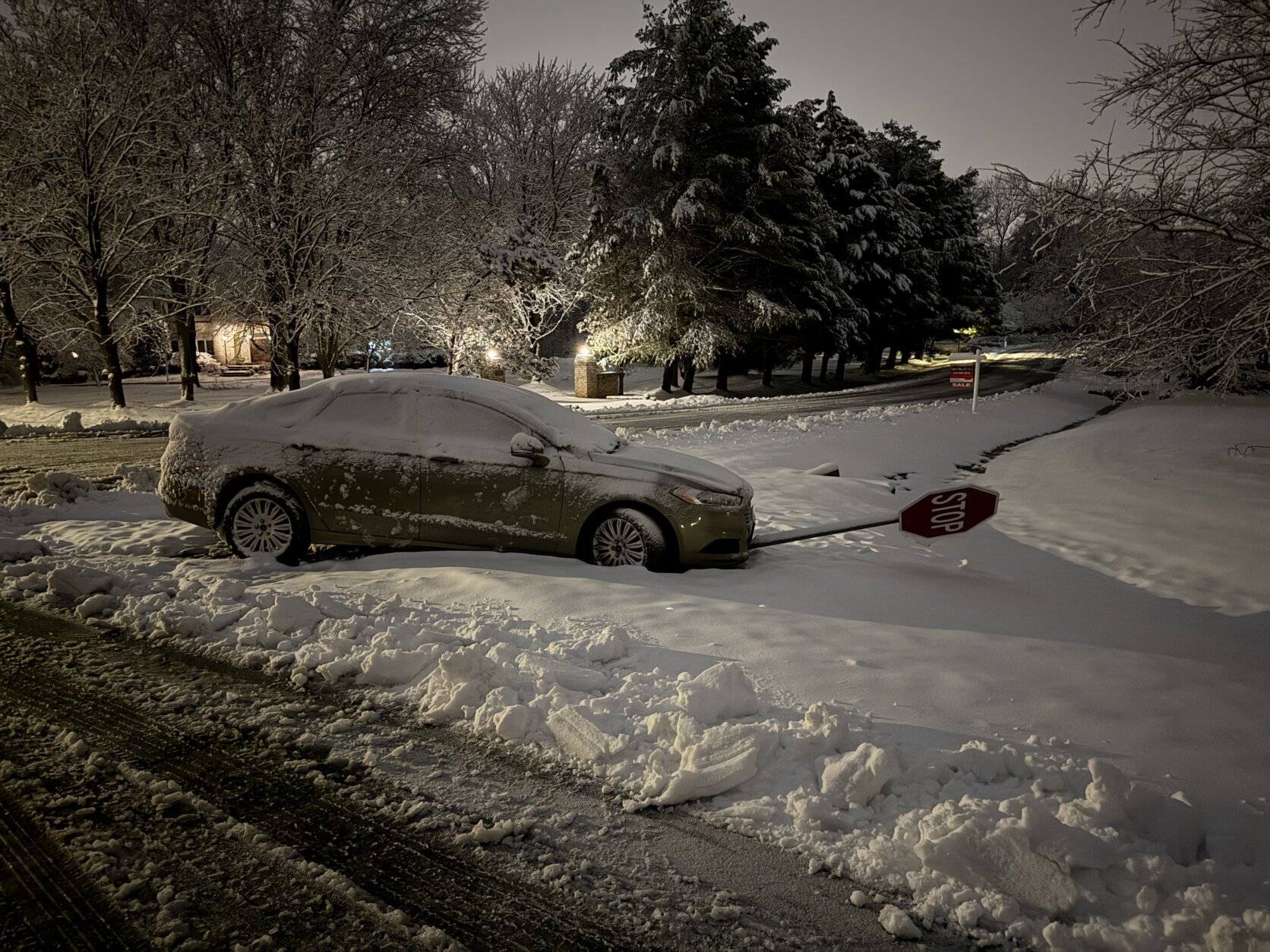
WTOP’s Luke Lukert observed roads in Montgomery County, Maryland, reporting that major roads were clear but neighborhoods remained slippery but passable. He also found “a few downed tree branches” and a car stuck after hitting a stop sign.
Ocean City prepares for snow blast
Meanwhile, Ocean City, Maryland, is currently under a blizzard warning until Monday night. The snow is stopping, but wind will remain the biggest problem, with forecasts suggest wind gusts approaching 50-60 mph.
“People are staying off the roads and not much is open,” 7News reporter John Gonzalez told WTOP. “It looks ominous.”
In a news release, Ocean City officials said accumulations are expected to be between 8 to 14 inches. The Maryland National Guard has been deployed to the Eastern Shore to assist. Gov. Wes Moore stated that this storm could be life threatening for portions of the state.
FORECAST
MONDAY: Light snow showers and flurries in the morning. Mostly cloudy and windy. Highs near 40.
Winds: NW 15—25 mph, gusts to 40 mph
MONDAY NIGHT: Clearing skies, refreeze possible. Temperatures in the 20s.
Winds: NW around 10 mph, gusts to 30 mph
TUESDAY: Winds easing after lunch. Sunny. Highs near 40.
Winds: NW 10—20 mph, gusts to 25 mph
WEDNESDAY: Increasing clouds. A few passing showers later in the day. Temperatures in the mid 50s.
THURSDAY: Cloudy. Cold rain likely, with a brief light mix possible early in the day. Highs near 50.
CURRENT CONDITIONS
WTOP’s Neal Augenstein and Luke Lukert contributed to this report.
Get breaking news and daily headlines delivered to your email inbox by signing up here.
© 2026 WTOP. All Rights Reserved. This website is not intended for users located within the European Economic Area.
About the Author
Discover more from USA NEWS
Subscribe to get the latest posts sent to your email.


