
Good morning and happy Saturday! This weekend’s forecast is a epitomized by the phrase, “it could have been worse”! Is it a “perfect” April weekend? Not necessarily (though I suppose that declaration is up to you), but it will stay mainly dry and temperatures will be in the neighborhood of average.
Here’s the scoop– there’s a storm headed through the Mid-Atlantic and parts of Southern New England.
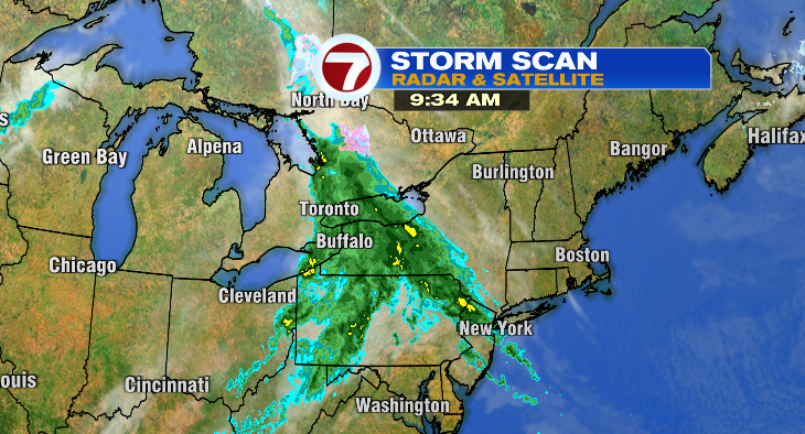
However, that storm is being nudged away from us (for the most part anyway) by a strong area of high pressure. The result is increasing clouds today, and a mostly cloudy start to Sunday.

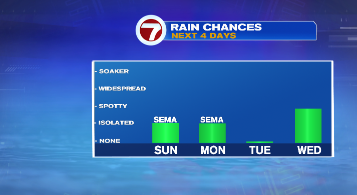
Clouds will eventually break just a bit later in the day Sunday. We could also see an isolated shower or two for the South Coast, Cape & Islands on Sunday and Monday as this storm continues on its way. But, again, it could be worse (at least for the sake of outdoor plans)! If high pressure wasn’t as strong, or in a different location, we could’ve seen a real washout of a weekend!
Talking temperatures– we started the day in the 30s, but the numbers are steadily climbing across the Bay State.
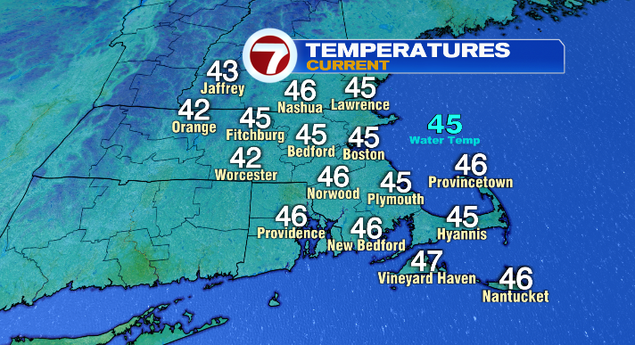
As our breeze becomes east-northeasterly, temperatures along the coast will stall in the upper 40s with the warmest spots just reaching 50 or so. Inland, temperatures will climb to the low to mid 50s. It’s a cool day for this time of year (average high is 60 degrees) but manageable enough.

Sunday will be slightly more mild– we’ll still be around 50 along the coast, but in the mid to upper 50s inland.

Monday we’ll see a bit more sunshine, but with this storm still in the vicinity, we’ll still be partly to mostly cloudy overall. We could, once again, see a shower or two for the South Coast, Cape & Islands. Temperatures will be near 50 for the coast, but between 55-60 inland. It’ll be a bit breezier as well.
Tuesday will be similar– not as breezy and with more sunshine, but temperatures are still in the low 50s for the coast and mid to upper 50s inland.
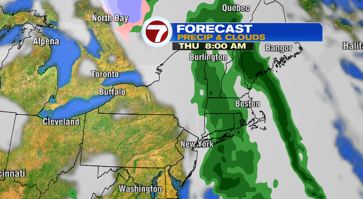
Our next chance of rain comes Wednesday with a few showers, but our next widespread chance of rain is Thursday as a cold front moves in from the west.
That could lead to showers and periods of rain on Thursday. We’ll keep an eye on this throughout the week!
About the Author
Discover more from USA NEWS
Subscribe to get the latest posts sent to your email.


