
We have a really funky 24 hours of weather ahead, starting with the fact that the rest of the forecast during daylight hours is extremely location-dependent… and VERY different from yesterday’s 70s temps.
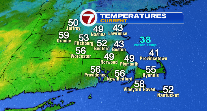
Thanks to a back-door cold front (basically just picture a cold front going backwards… we’re pretty literal in the field of meteorology), we’re seeing a windflow out of the northeast that’s kept the coast a lot cooler than inland cities. For example, cities like Gloucester have been stuck in the low and mid 40s, while Worcester has made it into the mid 50s.
That said, we’re looking at rising temperatures as we head into the evening, thanks to an encroaching warm front. With that front, our windflow will become southwesterly, ushering warmer air into New England, and putting temperatures in the mid to upper 50s (a few spots could even hit 60) overnight.
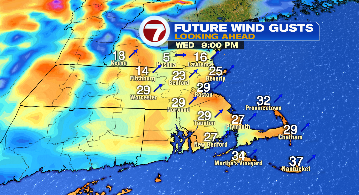
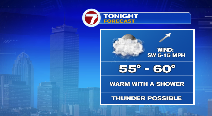
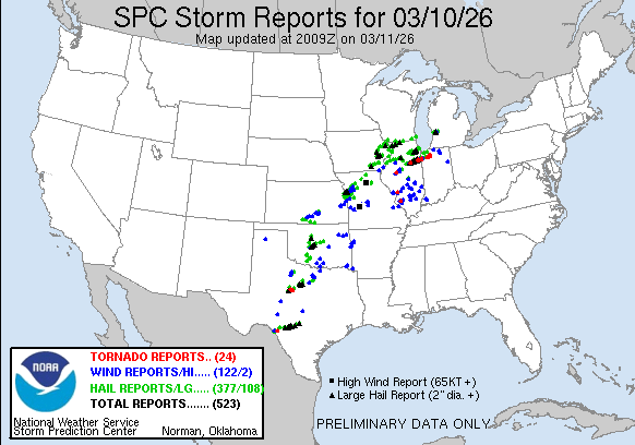
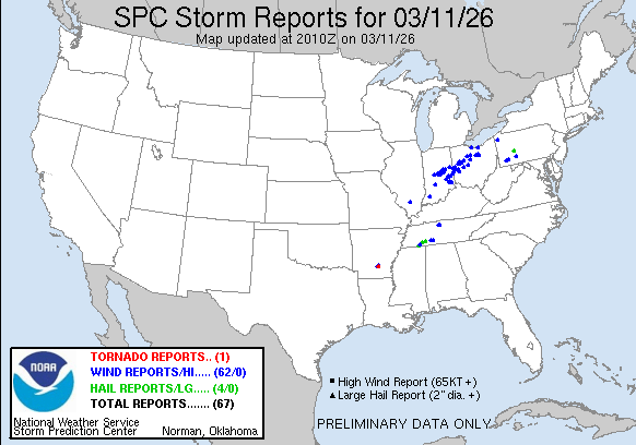
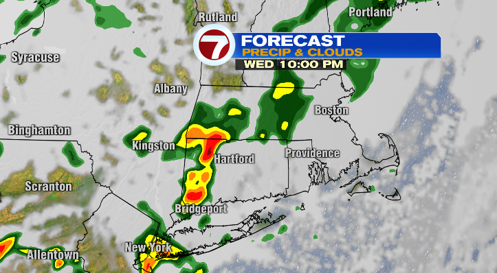
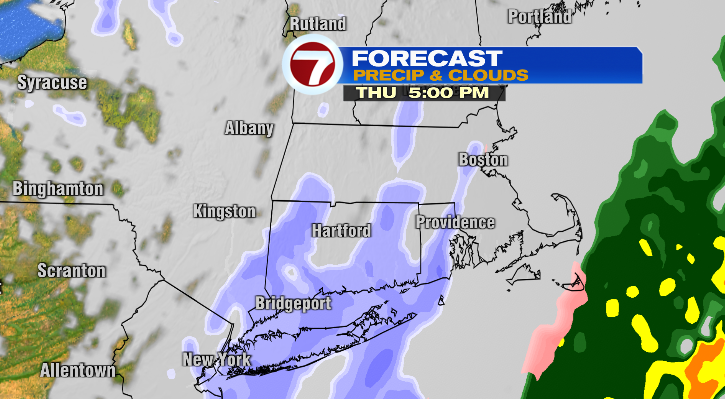
Along with the temperature bump, we’re looking at some spotty showers tonight and tomorrow morning, and even a rumble of thunder (especially for central and western Massachusetts). This precipitation is coming from the same storm that has left a trail of severe weather in its wake across the middle of the country. We’ve seen hundreds of severe storm reports from the South Central to the Midwest.
Thankfully, this storm loses a loooot of steam as it reaches New England. It’ll look much different by the time it reaches us tonight.
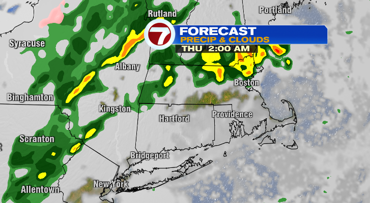
We’ll keep a shower or two and clouds around through Thursday morning. Temperature-wise, we’ll have what I like to call an upside-down day, where temperatures fall throughout the day rather than rising.
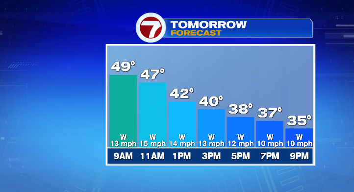
We’ll go from the 50s early in the morning, to the 40s by midday, to the 30s by the late afternoon and early evening. We’re also looking at the last of this storm’s energy in the evening as well, which will result in some light snow showers which will likely impact the evening commute. Considering the recent warmth and the ground temperatures, we aren’t looking at anything exciting in terms of accumulations. More “festive flakes” than anything else, but it could still make for a slower-than-normal drive home.
Colder air settles in from there, with temperatures in the 20s as we wake up on Friday. We’ll be in the low to mid 40s in the afternoon, with a mix of sun and clouds and a breeze from the west. Overall, it’ll be a distinctly average March day for New England.
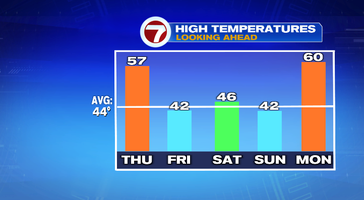
A quick moving storm to our north could throw a shower or snow shower way Friday evening. Saturday, however, will be dry and seasonable with highs in the mid 40s. It’ll be mostly to partly sunny. It’ll be quite breezy as well, with gusts in the 20s and 30s. Sunday will have increasing clouds with a late day shower or snow shower possible as well. Highs will be in the upper 30s and low 40s.
We’ll see another temperature boost Monday, but, once again, the warmth is tied in with a storm that looks like it’ll bring rain our way throughout the day.
About the Author
Discover more from USA NEWS
Subscribe to get the latest posts sent to your email.


