
South Florida has been grappling with stronger winds. On Tuesday, gusts peaked between 30 and 40 mph (41 mph officially at Miami International as well as Key West).
The intense winds evolved after the passage of a Cold Front and as strong High Pressure was building in behind the boundary.
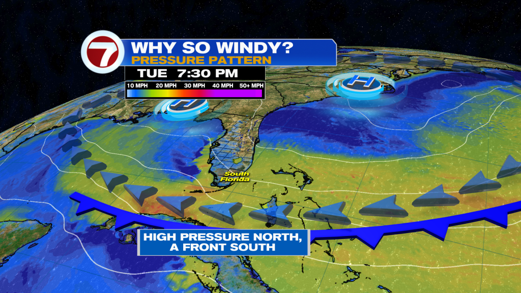
Notice (above) the areas in yellow and orange. That’s where we have the strongest pressure difference (hence the biggest winds). This is a temporary situation, and we’ve already reached the peak of the windy pattern. Having said that, it’ll take time and patience for the flow to relax in the coming days. That means we’re in for breezy weather on Earth Day, Wednesday.

Temperatures, during the rest of the midweek, will continue to feel pleasant. Realize that we typically have highs in the mid 80’s so this is still considered mild.
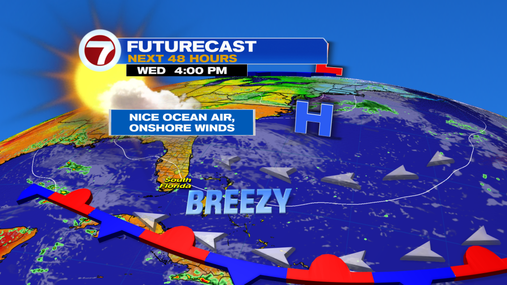
High Pressure over the western Atlantic will also promote mostly dry conditions. Despite the ocean flow, drier air has made a return and should hold, at least, until late in the week. There are some indications that (into Friday) small patches of moisture could usher in some isolated showers. The bigger story during the late week, though?
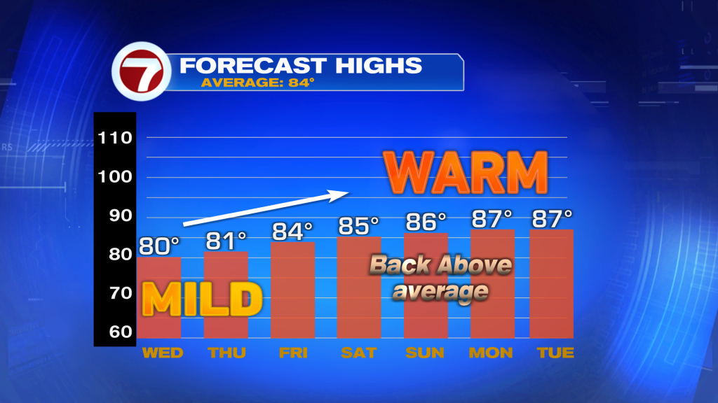
Once High Pressure weakens and departs, a warming trend will take over. Lighter winds are forecast to veer from the south and send temperatures higher for the weekend, and beyond. So, enjoy the current “spring break” with comfortable weather in place!
Copyright 2026 Sunbeam Television Corp. All rights reserved. This material may not be published, broadcast, rewritten or redistributed.
About the Author
Discover more from USA NEWS
Subscribe to get the latest posts sent to your email.


