
It was certainly a step in the milder direction yesterday as many of us away from Southeast Mass, cracked 70 degrees.
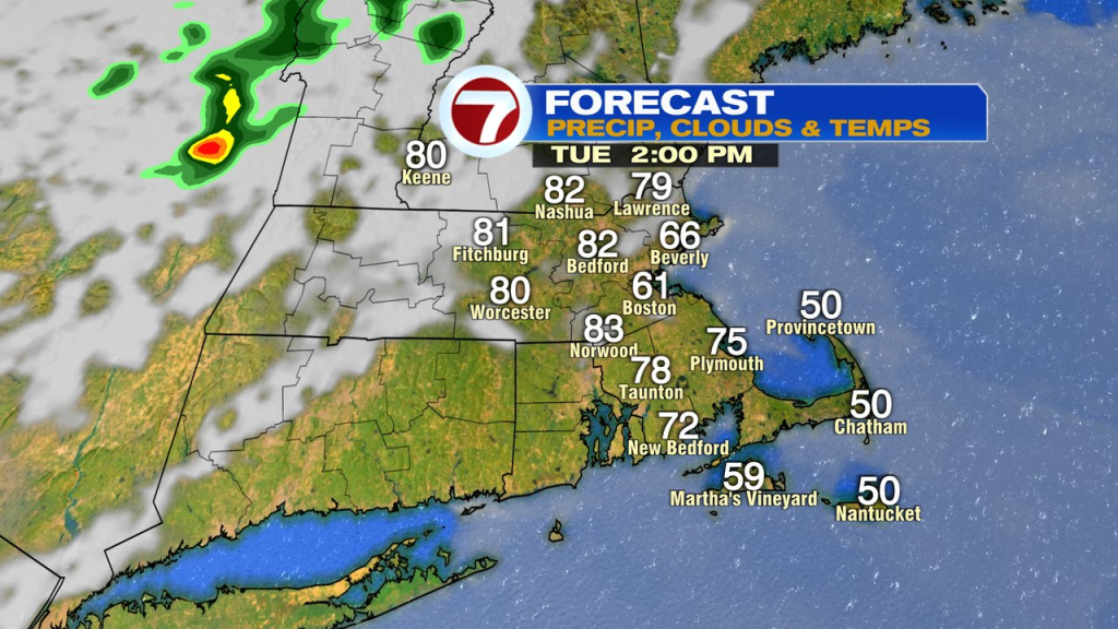
Today, we take it to another level as many locations away from the coastline will near and crack 80. The wind won’t be nearly as strong today, however, that also allows an ocean breeze to kick in for coastal communities, dramatically dropping the numbers there from the 70s back into the 50s and 60s.
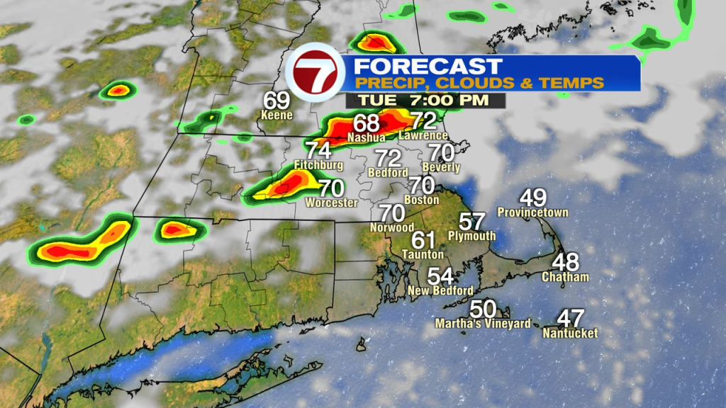
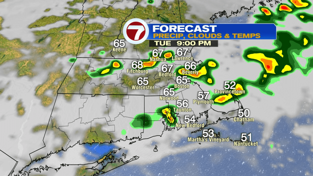
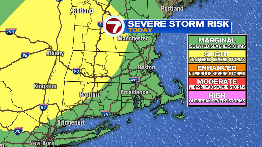
We talk summer warmth, we also talk summer storms. Watch for some scattered late day storms bringing the risk of cloud to ground lightning, downpours and isolated pockets of damaging wind gusts. We’ll track them after 5pm, through this evening, from northwest to southeast. The highest risk of a strong/severe storm is northwest of 495.
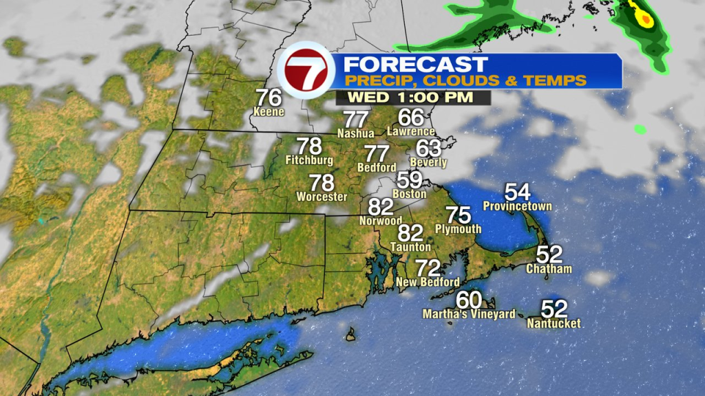
Tomorrow and Thursday will feature more warmth air. The high temp map for tomorrow is a bit tricky, as numbers may get stuck in the 50s/60s near the coast, especially across Northeast Mass. Farther inland, it’ll be warm again, 70s to low 80s. A few scattered showers and storms are possible, but much of the time is rain-free.
By the start of the weekend, it’ll be cooler Saturday, 50s coast, 60s inland.
By Marathon Monday, temps favor mid to upper 40s coast, 50s inland. Cool for sure, but a cool air mass that the Marathon runners will welcome!
About the Author
Discover more from USA NEWS
Subscribe to get the latest posts sent to your email.


