
Daylight Saving Time has started early this Sunday morning and that means we lost an hour of sleep and that sunrise and sunset times have been pushed back by 1 hour, both of which will now be happening in the 7PM hour.
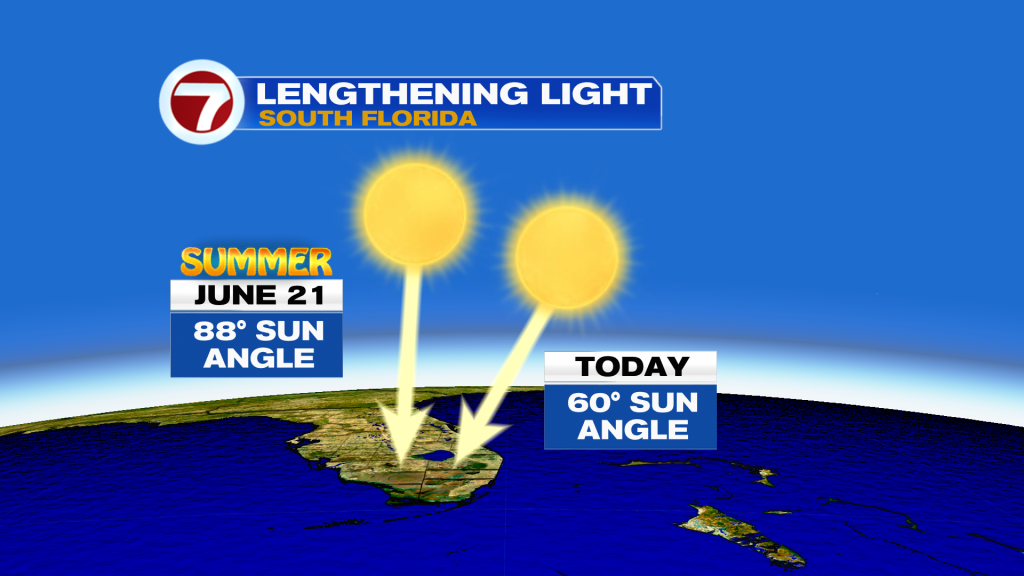
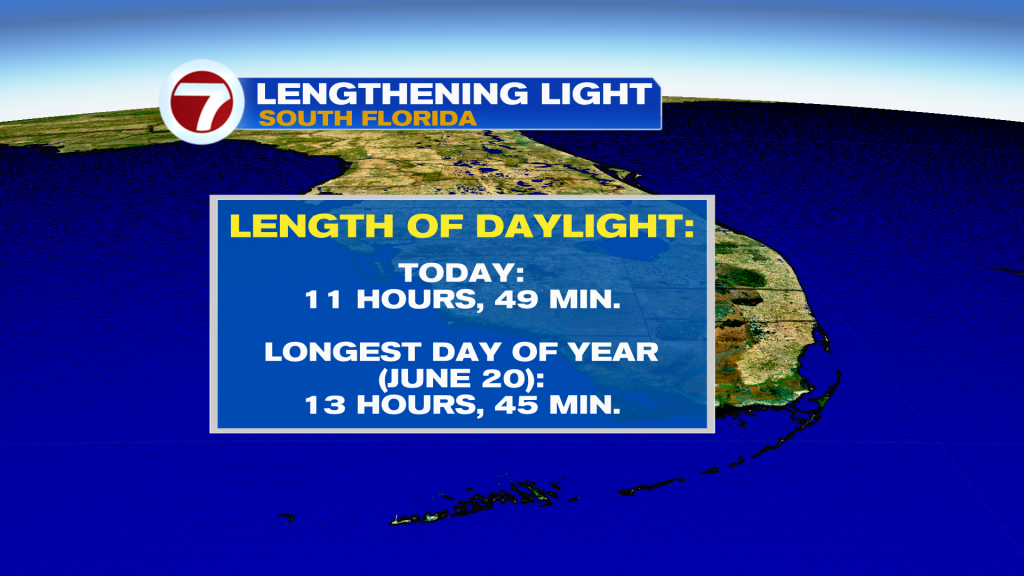
Going forward, our sun angle will continue to increase, meaning the sun will be higher up in the sky and less along the horizon during the day, contributing to longer days. Between now and the Summer Solstice in June, which is the longest day of the year, the amount of daylight will increase by nearly 2 hours in South Florida!
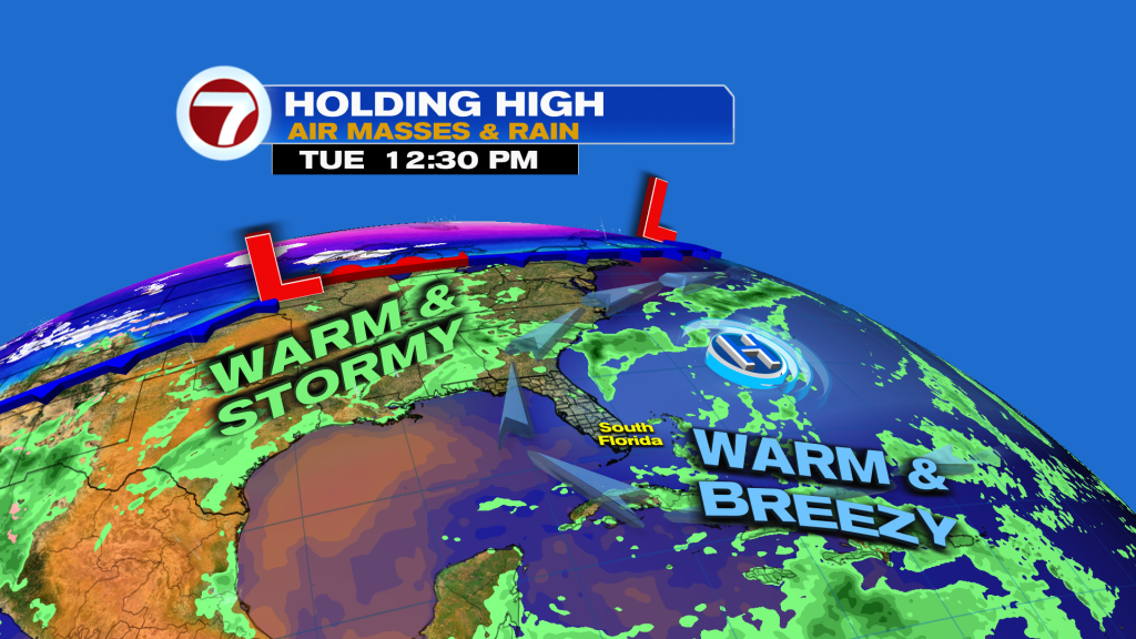
Today will be a beautiful day to spend it outdoors and catch the later sunset! Expect partly cloudy to mostly sunny skies with warm, humid and breezy conditions, contributing that another day with a high risk for rip currents at our east coast beaches.

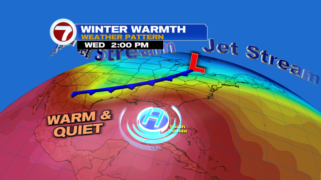
To begin the new work week, nothing changes to our pattern as fronts remain displaced well to our north. Expect generally sunny skies through midweek with low rain chances and a slightly weaker east-southeasterly breeze.
As a mid-level dome of high pressure gets closer to South Florida early to mid week, that will allow for high temperatures to increase by a degree or two with readings in the mid to potentially upper 80s through Thursday.
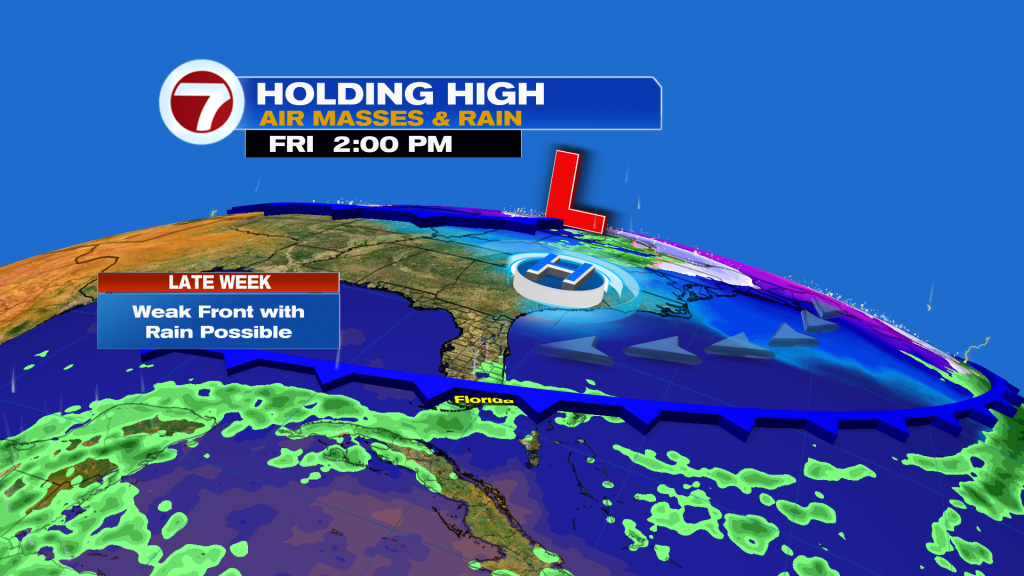
Temperatures are then forecast to drop slightly late-week as a very weak front arrives, stalls and fizzles near the area. This will also contribute to the chance for showers and storms by next weekend but it’s too early to know how great of a chance this rain risk is. As of this writing, it’s only a 30% chance for rain Friday and Saturday.
About the Author
Discover more from USA NEWS
Subscribe to get the latest posts sent to your email.


